Sunny Days, Frosty Mornings, and a Warmup Ahead This Week

Central New York is heading into one of those classic October stretches where the day can feel mild, the night can bite, and the forecast changes just enough to keep jackets, sunglasses, and rain gear all in the mix.
The next few days bring bright sunshine, patchy frost, a midweek warmup, and a couple of shower chances. For Madison County and nearby areas, the coldest air arrives during the overnight and early morning hours, while the warmest stretch looks to build by the weekend.
This is a week for layers. Afternoons will be comfortable at times, especially Wednesday, Saturday, and Sunday. Early mornings will tell a different story, with lows dipping into the 30s tonight and lower 40s later in the week.

The week starts sunny but chilly
This afternoon stays simple and pleasant. Sunshine dominates, with a high near 56 degrees. A northwest wind around 9 mph keeps the air feeling crisp, especially in open fields, on hilltops, and along exposed roads.
It is not a harsh wind, but it is enough to remind everyone that fall has settled in. In the sun, the afternoon should feel comfortable with a sweatshirt or light jacket. In the shade, especially later in the day, it will cool down quickly.
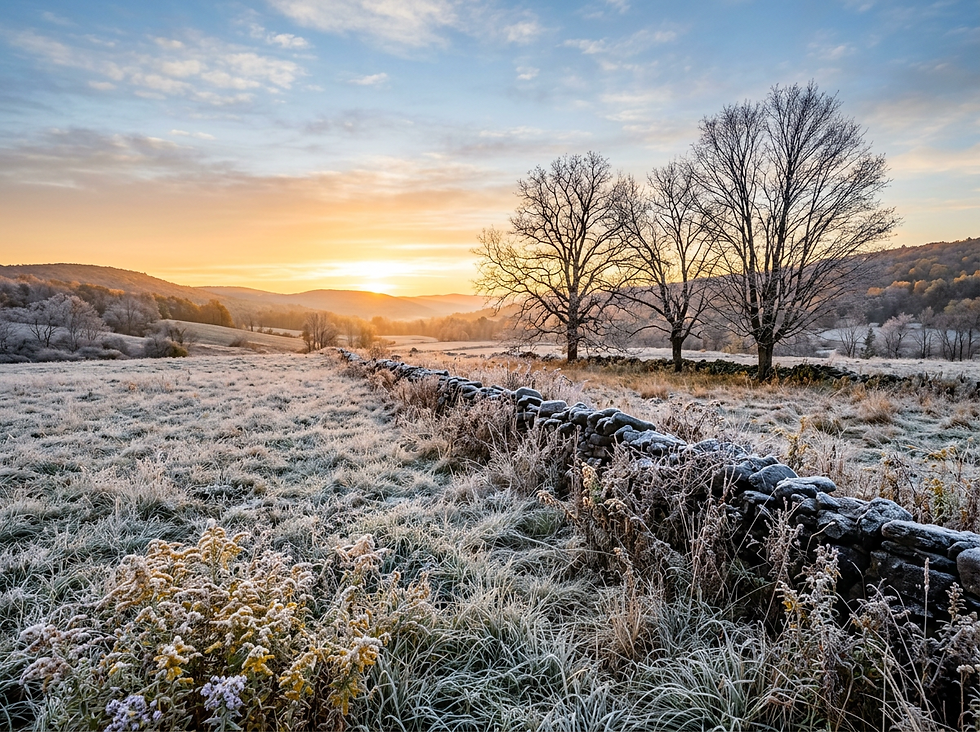
Tonight is the first key weather point of the week. Skies stay mostly clear, winds turn light and variable, and temperatures drop to around 35 degrees. That setup is favorable for patchy frost after 3 a.m.
Frost will not be uniform everywhere. The usual colder pockets have the best chance to see it first. Low-lying valleys, sheltered backyards, and rural spots away from larger bodies of water tend to cool faster when the wind goes calm and skies stay clear.
For gardeners, this is the night to pay attention. Tender plants may need a cover, or they may need to be brought indoors if they are in pots. Even a thin frost can damage late-season flowers, herbs, tomatoes, peppers, and other sensitive plants.
A few quick frost reminders:
Cover plants before the coldest part of the night, not after frost forms.
Use breathable fabric, sheets, or frost cloth rather than plastic touching leaves.
Move potted plants near the house or into a garage if possible.
Check outdoor pet water bowls in the morning, especially in colder hollows.
By Wednesday morning, patchy frost may linger before 7 a.m. After that, temperatures should recover quickly as the day warms.
Wednesday brings the warmup, then clouds increase
Wednesday offers one of the more noticeable changes of the week. After a frosty start in spots, temperatures climb to a high near 68 degrees. That is a big jump from the upper 30s in the morning and will make the afternoon feel much more comfortable.
Clouds increase through the day, so it may not be wall-to-wall sunshine from start to finish. Still, the air turns milder, and the breeze shifts. A southeast wind at 6 to 13 mph becomes southwest during the afternoon, helping draw in warmer air.
This is the kind of setup where the morning and afternoon feel like different seasons. Early commuters may need a warm jacket. By midafternoon, that same jacket may end up in the back seat.
Wednesday night turns more unsettled. A chance of showers develops, mainly after midnight. The sky stays mostly cloudy, with a low around 50 degrees. That is much milder than Tuesday night, which means frost is not a concern Wednesday night.
Rain chances sit around 40 percent, and any rainfall looks light. New rainfall amounts are expected to be less than a tenth of an inch. In plain terms, this does not look like a soaking rain for most spots. It is more of a scattered shower setup, especially overnight.

For outdoor plans Wednesday, the best conditions arrive during the day. Evening plans should stay mostly manageable, but by late night a few showers may move through. Keep a rain jacket handy if you will be out late or heading home after midnight.
The changing wind direction also matters. A southeast breeze in the morning can feel cool, especially before the sun gets high. The southwest shift later helps support the warmer high near 68. That kind of wind change often signals the next weather system moving closer.
Thursday stays mild with a few showers possible
Thursday starts with the chance for showers, mainly before 2 p.m. Skies turn partly sunny as the day goes on, and temperatures reach a high near 65 degrees. That keeps the day on the mild side for October, though it will not feel quite as warm as Wednesday in areas that hold onto clouds longer.
The chance of precipitation is around 30 percent, so not everyone will see rain. Showers should be scattered and light. A full washout is not expected.
The bigger change Thursday may be the breeze. A west wind blows at 5 to 11 mph, with gusts as high as 21 mph. That is enough to knock leaves around, add a chill to the air, and make open areas feel cooler than the thermometer suggests.
If Wednesday is the warm transition day, Thursday is the “passing system” day. It brings clouds, a few showers, and a modest west wind behind the weather disturbance.
Thursday night turns partly cloudy, with a low around 42 degrees. That is cooler than Wednesday night but still not as cold as Tuesday night. Some sheltered spots could feel quite chilly by daybreak Friday, but the broader frost risk looks lower based on the forecast low.
Here is the early-week pattern in a simple view:
Period | Expected weather | High or low | What it means |
This afternoon | Sunny | High near 56 | Crisp and pleasant |
Tonight | Mostly clear with patchy frost late | Low around 35 | Protect sensitive plants |
Wednesday | Frost early, then increasing clouds | High near 68 | Big daytime warmup |
Wednesday night | Mostly cloudy with showers possible | Low around 50 | Mild, damp late |
Thursday | Chance of showers, partly sunny | High near 65 | Breezy at times |
The key point is that the coldest air comes first, then the region turns milder before another small dip late in the week.
Friday and Saturday look calm and comfortable
By Friday, the forecast settles down again. Expect mostly sunny skies with a high near 61 degrees. That is a little cooler than Wednesday and Thursday, but still comfortable for mid-October activities.
Friday night turns partly cloudy, with a low around 41 degrees. That is chilly enough for a heavier sweatshirt, fleece, or fall jacket during evening events. It is not a deep cold, but it will feel brisk after sunset.
Saturday looks like one of the best days of the week. Mostly sunny skies return, with a high near 68 degrees. For outdoor chores, youth sports, pumpkin picking, hiking, farmers markets, or fall drives, Saturday brings a strong mix of sunshine and mild air.
Saturday night stays mostly clear, with a low around 49 degrees. That is a comfortable setup compared with the frosty start earlier in the week. It also sets the stage for an even warmer Sunday.

This stretch from Friday into Saturday is the most dependable part of the forecast for dry outdoor time. Friday is cooler, Saturday is warmer, and the rain chances stay away.
That does not mean mornings will feel warm. Central New York can cool fast at night under clear or partly cloudy skies. Even when the afternoon high reaches the 60s, morning temperatures in the 40s can make the first few hours of the day feel sharp.
For planning purposes, think in two layers:
Morning and evening | Afternoon |
Jacket, fleece, or sweatshirt | Long sleeves or lighter layer |
Chilly in valleys and shaded spots | Comfortable in sunshine |
Good night for a warm drink outside | Good daylight for yard work |
If leaves are piling up, Friday and Saturday offer decent windows for cleanup. Thursday’s wind may bring more leaves down, while Friday and Saturday provide better weather to rake, mow, or prep gardens for colder nights ahead.
Sunday warms up before the next shower chance
Sunday is the warmest day in the current forecast. Mostly sunny skies are expected, with a high near 73 degrees. That is mild enough to feel almost late-summer like during the afternoon, especially in full sun and away from wind.
This is the day when the earlier frost will feel far behind. By Sunday afternoon, patios, trails, and open fields should feel inviting. Anyone planning fall outings will likely want to take advantage of the daylight hours.
Sunday night brings the next chance of showers. The sky turns mostly cloudy, with a low around 53 degrees. Rain chances rise to around 40 percent.
Columbus Day keeps a shower chance in the forecast, though it does not look like an all-day rain at this point. Expect partly sunny skies, a high near 68 degrees, and a 30 percent chance of showers.
That means the long weekend forecast has two different moods. Saturday and Sunday look mainly dry and mild, with Sunday likely the warmest. Sunday night into Columbus Day looks more unsettled, but still mild.
Here is the weekend and holiday outlook:
Day | Forecast | High or low | Planning note |
Friday | Mostly sunny | High near 61 | Cooler but dry |
Saturday | Mostly sunny | High near 68 | Great fall day |
Sunday | Mostly sunny | High near 73 | Warmest day of the stretch |
Sunday night | Mostly cloudy with showers possible | Low around 53 | Keep rain gear nearby |
Columbus Day | Partly sunny with showers possible | High near 68 | Mild with some uncertainty |
The shower chances late Sunday and Monday are still several days away, so details can shift. At this range, the useful takeaway is simple: plan outdoor events for Saturday and Sunday daylight if possible, then keep backup options ready for Sunday night and Monday.

What this pattern means for daily plans
This forecast has three main themes: cold mornings, mild afternoons, and limited rain chances.
The first priority is tonight’s frost risk. If sensitive plants are still outside, protect them before going to bed. Patchy frost after 3 a.m. can form quickly under clear skies and light winds.
The second theme is the midweek warmup. Wednesday jumps close to 68 degrees after a frosty start, then Thursday stays mild near 65. That is a fast shift, and it can make dressing for the day tricky. Layers will help more than a heavy coat.
The third theme is the weekend warmup. After a pleasant Friday and Saturday, Sunday climbs into the low 70s. That is the standout day for warmth. If there is one day to plan a longer walk, leaf-peeping drive, or outdoor cleanup, Sunday looks appealing before showers return at night.
A few practical notes for the week:
For gardeners
Cover tender plants tonight. Later in the week looks milder, but another cold morning can still sneak up in October.
For commuters
Watch for patchy frost early Wednesday in colder spots. It may be limited, but car windshields and bridges can cool quickly.
For outdoor work
Friday and Saturday look like steady windows. Thursday may be breezy, and showers could interrupt the first half of the day.
For weekend plans
Saturday and Sunday daylight look favorable. Sunday night and Columbus Day carry the next shower chances.
For fall events
Bring a jacket for evening plans, even on warmer days. Temperatures will drop fast after sunset.
The biggest weather swing comes between tonight and Sunday. A low near 35 tonight will give way to a high near 73 by Sunday. That nearly 40-degree spread captures the season well. Central New York often gets these sharp October contrasts, with frost in the hollows one morning and warm sunshine a few afternoons later.
So keep the frost cloth handy, but do not put away the sunglasses. This week starts chilly, turns mild, and gives the region several good chances to enjoy fall before the next round of showers arrives.


Comments