Stormy Start, Sunny Midweek: Your Week Ahead Weather Outlook

A damp, unsettled stretch opens the week across Central New York, but the pattern does not stay stormy for long. The main weather focus comes this afternoon and tonight, when showers and thunderstorms become more likely. After that, Tuesday and Wednesday bring a clearer, brighter break before another low-end shower chance returns late Wednesday night into Thursday.
For the Canastota area and nearby parts of Central New York, this is a week with several practical shifts: keep the umbrella close today, enjoy a comfortable midweek stretch, then watch for scattered showers again before a cooler, quieter Friday and Saturday.
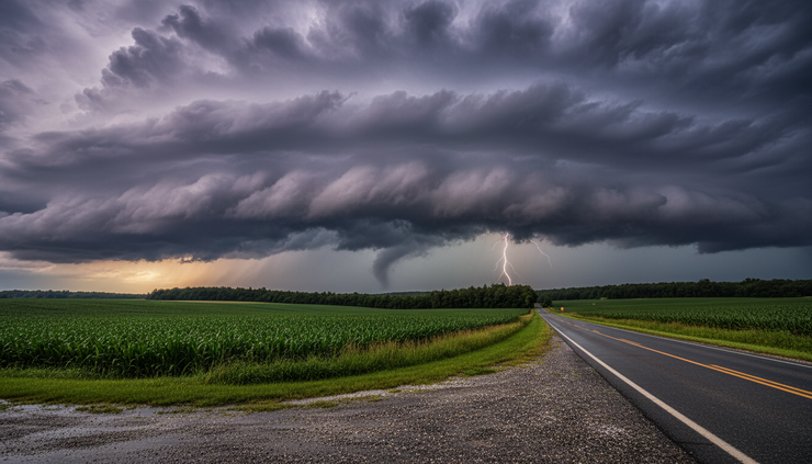
The stormiest part of the forecast comes first
The week starts warm, humid enough for showers and storms, and mostly cloudy. This afternoon, the chance for showers and thunderstorms begins between 2 p.m. and 4 p.m. After 4 p.m., showers become more likely, and a thunderstorm remains possible.
The high temperature should reach near 83°F, which is warm enough to support a muggy feel when clouds thin and showers hold off for a bit. Winds stay manageable from the southwest at 5 to 9 mph, so widespread wind issues are not the main story based on this forecast. The bigger concern is the timing of rain and thunder during the late afternoon and early evening.
The chance of precipitation this afternoon is 60%. That does not mean it will rain for 60% of the day. It means there is a fairly good chance that any given spot in the forecast area sees measurable rain. Some places may get only a brief shower. Others could get a heavier thunderstorm.
Expected rainfall for the afternoon is generally light, with new rainfall amounts of less than a tenth of an inch. Thunderstorms can change that quickly. A storm that moves slowly or briefly intensifies can produce higher totals in a small area, even while nearby roads stay barely wet.
That kind of setup is familiar in Central New York. One town can pick up a downpour while another, only a few miles away, sees mostly clouds and a sprinkle. The forecast points to scattered to likely rain, not an all-day washout from start to finish.
The most useful plan for this afternoon is simple:
Keep rain gear nearby if heading out after lunch.
Expect wet roads for the evening drive in spots.
Move indoors if thunder is heard.
Give extra time for errands, practices, or outdoor work after 4 p.m.
Watch for brief heavy rain under stronger storms.
Lightning is the hazard to take seriously. Even if a storm does not look severe, lightning can reach well outside the heaviest rain. If thunder is close enough to hear, the safest place is indoors or inside a hard-topped vehicle.
Tonight stays unsettled before showers taper
The unsettled pattern continues tonight, especially before 11 p.m. Showers and thunderstorms are likely during the evening, then the forecast shifts toward a chance of showers later at night.
Temperatures stay mild, with a low around 64°F. Winds turn light from the west at 3 to 5 mph, so the night should not feel especially windy. The sky remains mostly cloudy, and damp conditions may linger even where rain becomes lighter or more scattered.
The chance of precipitation tonight remains 60%. Rainfall totals look a little higher than the afternoon period, with new precipitation amounts between a tenth and a quarter of an inch. Thunderstorms could again produce higher amounts in spots.
For anyone traveling tonight, the early evening looks more active than the late-night period. That matters for:
Evening commutes
Youth sports and outdoor practices
Patio dining
Dog walks
Late shopping trips
Local travel on rural roads
Wet pavement, glare from headlights, and pockets of heavier rain can slow things down. Rural routes around Central New York can also collect water in low spots during heavier bursts, even when rainfall totals are not high for the whole area.
If storms are nearby, avoid standing under isolated trees, near open fields, or beside metal fencing. Central New York has plenty of open farmland, parks, and lake-adjacent recreation areas where lightning safety can be overlooked. A quick move indoors is worth it.
Tuesday brings a welcome reset
Tuesday brings a noticeable change. The forecast calls for mostly sunny skies and a high near 81°F. Winds come from the west at 5 to 9 mph, which should help the air feel a touch fresher after Monday’s damp weather.
This is the first strong “get things done outdoors” day of the week. Lawns, gardens, sports fields, and sidewalks may still be wet early, especially where storms dropped heavier rain Monday night. By midday and afternoon, the mix of sun, mild warmth, and light wind should help surfaces dry.
Tuesday should be a good day for:
Mowing, if the lawn has had time to dry
Outdoor lunch plans
Walking or biking
Opening windows for a bit
Catching up on errands
Work around the yard
The day does not look sharply cooler. A high near 81°F still feels like summer, but without the same storm focus from Monday. For much of Central New York, that combination of sunshine, warm air, and lower rain chances makes Tuesday one of the better days of the week.
Tuesday night turns quieter, though clouds increase. The low drops to around 59°F, with light and variable wind. That is a comfortable night by summer standards. Open-window weather may be possible for many homes, especially away from the warmest village and city centers.
The increase in clouds Tuesday night does not bring an immediate rain chance in the forecast. It simply signals the atmosphere starting to change again. The next shower chance waits until late Wednesday night.

Wednesday may be the best day of the week
Wednesday stands out as the most settled day in this outlook. The forecast calls for sunny skies and a high near 82°F. Morning winds stay calm, then become west at 5 to 7 mph during the afternoon.
That is a classic fair-weather setup for Central New York. It is warm, bright, and not especially windy. If the week has one day that best suits outdoor work, local travel, or time by the water, Wednesday is the leading candidate.
The sunshine should help dry out any lingering damp ground from Monday and Monday night. Garden beds, grassy fields, and shaded driveways may still hold moisture early, but the afternoon should be pleasant.
Good uses for Wednesday include:
Outdoor projects that need a dry window
Longer walks or hikes
Local road trips
Farmers market stops
Time at a park
Cleaning up after Monday’s showers
Planning outdoor meals
Sun protection still matters. A sunny day near 82°F can sneak up on people, especially after a cloudy and stormy start to the week. Shade breaks, water, sunglasses, and sunscreen all make sense if spending several hours outside.
Wednesday night brings the next change. The forecast turns partly cloudy, with a low around 60°F. A chance of showers develops mainly after 2 a.m., with a 40% chance of precipitation.
That timing is useful. Most of Wednesday evening looks dry for dinner plans, walks, or outdoor events. The shower risk comes later at night into early Thursday. People with early Thursday plans should check the forecast before heading out, since wet roads or passing showers may be around by morning.
Thursday looks mixed, not washed out
Thursday brings a less settled sky, but the forecast does not point to steady rain all day. Instead, it shows two windows for scattered showers.
A chance of showers is possible before 8 a.m., then another chance returns after 2 p.m. Between those periods, the day may turn mainly dry for a time. Skies stay partly sunny, and the high reaches near 79°F.
The chance of precipitation is 30%, which is lower than the Monday and Monday night setup. That suggests scattered activity rather than widespread rain.
For planning purposes, Thursday is a “check the radar before you leave” kind of day. Many hours may be usable. Still, a passing shower could interrupt outdoor work or travel, especially early and again later in the afternoon.
Thursday night keeps a chance of showers before 2 a.m. Skies remain mostly cloudy, with a low around 56°F. The precipitation chance stays at 30%.
That lower Thursday night temperature is one of the signs that the air mass is changing. By Friday morning, the week should feel a bit cooler and more comfortable compared with the warm, stormy start.
How Thursday differs from Monday
Monday has the higher rain and thunderstorm chance, with showers likely late in the day and showers and storms likely into the evening. Thursday has lower rain odds and a more broken-up shower pattern.
The difference matters for planning. Monday asks for extra caution with lightning and late-day storms. Thursday asks for flexibility, but it does not look like the same level of disruption based on this forecast.
Day | Main weather concern | Planning takeaway |
This afternoon | Showers and thunderstorms, especially after 4 p.m. | Keep indoor backup plans ready |
Tonight | Showers and storms likely before 11 p.m. | Use care during evening travel |
Tuesday | Mostly sunny and warm | Good day to dry out and catch up |
Wednesday | Sunny and warm | Best outdoor day of the week |
Thursday | Scattered shower chances | Keep plans flexible |
Friday | Mostly sunny and cooler | Comfortable end to the workweek |
Saturday | Mostly sunny | Good start to the weekend |
Sunday | Chance of showers | Watch for updates |

Friday and Saturday turn cooler and calmer
Friday brings another pleasant shift. The forecast calls for mostly sunny skies and a high near 75°F. That is cooler than the early-week highs in the low 80s, and it should feel more comfortable for outdoor plans.
Friday night looks quiet and crisp for the season, with mostly clear skies and a low around 52°F. Some of the cooler rural valleys and open areas may feel especially fresh by early Saturday morning.
This part of the forecast is the reward after the unsettled start. It gives the region a chance to dry out and settle down. If Monday’s storms leave the garden watered, the lawn damp, or outdoor furniture soaked, Friday’s sunshine and lower humidity should help.
Saturday continues the quieter stretch. The forecast calls for mostly sunny skies and a high near 76°F. Saturday night becomes partly cloudy, with a low around 54°F.
For weekend planning, Saturday currently looks like the better half of the weekend. It should support outdoor events, yard work, travel, and recreation without a strong rain signal in the forecast.
Central New York weather can shift, especially several days out, but the broad message is clear: Friday and Saturday look calmer than the beginning of the week.
Sunday brings the next shower chance
Sunday is not a washout in this outlook, but the forecast does bring back a chance of showers. Skies look partly sunny, with a high near 78°F. The chance of precipitation is 40%.
A 40% chance this far out is a signal to stay flexible rather than cancel plans. Some areas may stay dry for much of the day. Others may see a passing shower. The exact timing will matter, and that detail usually becomes clearer as the day gets closer.
For now, Saturday looks more reliable for outdoor events. Sunday still may have plenty of usable time, but it carries more uncertainty.
If planning a picnic, hike, round of golf, graduation gathering, or outdoor work on Sunday, build in a backup option. A tent, covered porch, flexible start time, or indoor plan can make the difference between a minor inconvenience and a scrambled afternoon.
What this pattern means for daily life in Central New York
This is not a single-note forecast. The week moves through several phases, and each one affects daily routines differently.
The warm, stormy start may slow down Monday afternoon and evening. Tuesday and Wednesday then open a drier window. Thursday adds a few shower chances, but with lower odds. Friday and Saturday look cooler and pleasant. Sunday brings the next chance for showers.
That pattern matters because Central New York lives close to the weather. A slight timing change can affect school sports, farm work, construction, lake plans, road trips, and backyard gatherings.
For commuters
The most likely travel slowdowns come late this afternoon and tonight. Heavy downpours can cut visibility quickly, even if they do not last long. Wet roads may produce spray, and ponding can happen in poor-drainage spots.
Tuesday and Wednesday look much better for commuting. Thursday may bring a few wet periods, especially early and later in the day. Friday looks comfortable and mostly sunny.
For outdoor workers
Monday afternoon and evening carry the main thunder risk. Outdoor work should pause when thunder is nearby. Tuesday and Wednesday offer better working conditions, with Wednesday likely the driest and sunniest day.
Thursday may require some flexibility. Friday and Saturday look favorable, with cooler highs in the mid-70s.
For gardeners and homeowners
Rainfall today and tonight may be enough to water many gardens, though totals will vary. Some locations may receive light amounts, while thunderstorm spots may pick up more.
Tuesday and Wednesday should offer time to weed, mow, trim, and clean up. If Monday night brings heavier rain locally, wait until lawns and garden beds dry enough to avoid ruts or compacted soil.
Friday and Saturday look excellent for yard work, especially with cooler temperatures.
For sports and outdoor events
The biggest concern is Monday after 4 p.m. and Monday evening. Lightning and downpours could interrupt practices, games, or outdoor gatherings.
Tuesday and Wednesday look favorable. Thursday has a lower shower risk, but organizers should still watch the sky and check updates. Saturday looks better than Sunday for weekend events at this point.
The day-by-day outlook at a glance
Here is the forecast in a simpler daily format.
This afternoon
Showers and thunderstorms may develop between 2 p.m. and 4 p.m., then showers become likely after 4 p.m. A thunderstorm remains possible. Skies stay mostly cloudy, with a high near 83°F. Southwest wind runs 5 to 9 mph. Rain chance is 60%.
Most places should see light rainfall totals, but thunderstorms may produce locally higher amounts.
Tonight
Showers and thunderstorms are likely before 11 p.m., followed by a chance of showers. The night stays mostly cloudy, with a low around 64°F. West wind remains light at 3 to 5 mph. Rain chance stays 60%.
New precipitation may range from 0.10 to 0.25 inches, with higher amounts possible in thunderstorms.
Tuesday
Mostly sunny, with a high near 81°F. West wind runs 5 to 9 mph. This is a much calmer day after the unsettled Monday pattern.
Tuesday night
Clouds increase, with a low around 59°F. Winds turn light and variable. Rain is not the main concern.
Wednesday
Sunny, with a high near 82°F. Calm wind becomes west at 5 to 7 mph during the afternoon. This may be the best all-around outdoor day of the week.
Wednesday night
Partly cloudy, with a low around 60°F. A chance of showers develops mainly after 2 a.m. Rain chance is 40%.
Thursday
A chance of showers is possible before 8 a.m., then again after 2 p.m. Skies stay partly sunny, with a high near 79°F. Rain chance is 30%.
Thursday night
A chance of showers continues before 2 a.m. The night stays mostly cloudy, with a low around 56°F. Rain chance remains 30%.
Friday
Mostly sunny, with a high near 75°F. Cooler and comfortable.
Friday night
Mostly clear, with a low around 52°F. A fresh, quiet night.
Saturday
Mostly sunny, with a high near 76°F. This looks like the better weekend day for outdoor plans.
Saturday night
Partly cloudy, with a low around 54°F.
Sunday
Partly sunny, with a high near 78°F. A chance of showers returns, with a 40% chance of precipitation.

Key takeaways for the week ahead
The forecast starts active and ends more comfortably. The main weather watch period is this afternoon through tonight, when showers and thunderstorms are most likely. Rainfall totals should stay modest for many areas, but any thunderstorm can produce a quick downpour and locally higher amounts.
Tuesday and Wednesday bring the best midweek stretch, with sunshine, highs near the low 80s, and lighter winds. Wednesday looks especially favorable for outdoor plans.
Thursday is more mixed, with scattered shower chances early and later in the day. It does not look as stormy as Monday, but it is worth keeping plans flexible.
Friday and Saturday bring the more comfortable side of the week, with mostly sunny skies and highs in the mid-70s. Sunday carries the next shower chance, so weekend plans look safest on Saturday for now.
The simple plan: stay weather-aware today, make the most of Tuesday and Wednesday, keep an eye on Thursday, and enjoy the cooler finish to the week.


Comments