Rainy Start, Then a Mostly Mild Week Ahead

A wet morning sets the tone today, but it will not define the whole week. The steadiest showers are expected mainly before 10 a.m., followed by a stretch of quieter, mild weather across Central New York.
For Madison County and nearby parts of the region, the big picture is simple: rain early, clouds and fog at times, then several days with highs in the mid to upper 60s. It will feel more like a soft, damp spring pattern than a stormy one. No major cold snap shows up in this forecast, and winds stay light through much of the week.
The tradeoff is sunshine. Some days will brighten up nicely, while others stay more gray than clear. Morning fog may also slow the start of Monday, especially in valleys and sheltered spots where calm winds let moisture linger near the ground.

Rain is most likely early today
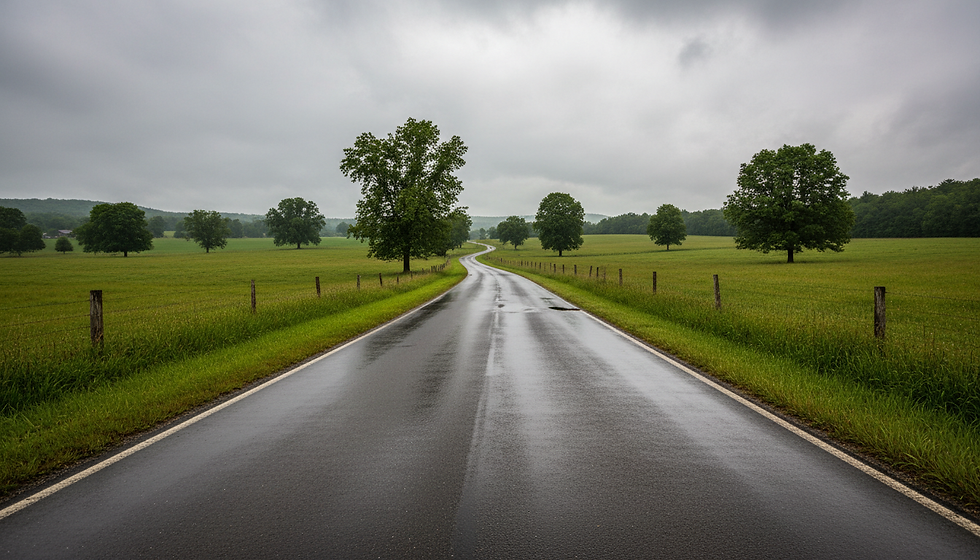
Today brings the only truly wet stretch in the forecast. Showers are expected mainly before 10 a.m., with a 100% chance of precipitation. Rain totals should stay fairly modest, generally between a tenth and a quarter of an inch.
That is enough to make roads damp, slow down the morning commute, and keep outdoor plans soggy for a while. It is not the kind of rainfall that points to a washout all day, but the morning hours will need rain gear, windshield wipers, and a little extra patience.
Temperatures should still climb to near 63 degrees, which keeps the day mild despite the clouds and showers. An east wind around 3 to 6 mph will not add much bite. The air may feel cool and damp early, then a bit more comfortable once the steadier rain tapers.
For anyone heading out this morning, the best plan is simple:
Keep the umbrella or rain jacket handy before midmorning.
Watch for wet leaves, puddles, and slick spots on secondary roads.
Give school buses and morning traffic extra room.
Expect the day to improve gradually after the early showers move through.
The rain should not come with strong wind. That matters because light winds usually mean fewer weather-related disruptions, even when the pavement is wet. The main issue today is timing, not intensity.
By later today, the weather trends quieter. Clouds may hang around for a while, but the most organized showers should already be out of the way.
Fog may develop late tonight and early Monday
Tonight turns cloudy at first, then gradually becomes partly cloudy. Temperatures fall to around 44 degrees, which is seasonably cool but not harsh. Winds turn light as a north breeze around 5 mph becomes calm during the evening.
That calmer setup matters. Patchy fog is expected after 4 a.m., and it may linger into the early part of Monday morning, mainly between 7 a.m. and 8 a.m.
Fog is often uneven in Central New York. One hilltop may stay clear while a nearby valley becomes murky. Low-lying roads, open fields, creeks, ponds, and sheltered valleys are typically the first places to see visibility drop.
Monday itself looks more comfortable once any early fog lifts. Expect partly sunny skies and a high near 66 degrees. Winds remain light, starting calm before becoming northeast around 5 mph during the afternoon.
That makes Monday one of the more useful days of the forecast. It will not be perfectly sunny, but it should be mild, calmer, and much drier than today.

What patchy fog means for the morning
Patchy fog does not mean every road will be covered. It means visibility may change quickly over short distances. A driver could go from clear conditions into a low cloud of fog in less than a mile.
That can be especially common in rural areas around open farmland, low fields, and shaded roads. Fog may also be more noticeable where the ground remains damp from today’s rain.
A few practical reminders can help:
Use low-beam headlights when visibility drops.
Leave more space between vehicles.
Slow down before entering foggy low spots.
Avoid using high beams, which can reflect light back and make it harder to see.
Once the sun gets higher and mixing improves, the fog should fade. Monday then settles into a partly sunny and mild afternoon.
The middle of the week stays mild and mostly cloudy
Tuesday keeps the mild pattern going, but it brings more cloud cover. Skies look mostly cloudy, with a high near 65 degrees. An east wind around 3 to 7 mph may add a light chill in shaded spots, though temperatures remain comfortable for this time of year.
Tuesday night stays mostly cloudy, with a low near 43. That continues the theme of cool but not cold nights.
Wednesday brings a brighter break. Mostly sunny skies are expected, with a high near 65 degrees. That may end up being one of the better outdoor days of the week, especially for yard cleanup, errands, sports practices, or a longer walk after work.
Wednesday night turns partly cloudy with a low around 43.
Here is the early-to-midweek forecast at a glance:
Day | Sky | High | Low |
Today | Showers mainly before 10 a.m. | 63 | 44 tonight |
Monday | Patchy morning fog, then partly sunny | 66 | 44 |
Tuesday | Mostly cloudy | 65 | 43 |
Wednesday | Mostly sunny | 65 | 43 |
The numbers do not swing much. Highs stay in a narrow range from the lower to mid 60s, while overnight lows mostly settle in the lower to mid 40s. That steady pattern is helpful. It means fewer wardrobe surprises and less day-to-day shock for gardens, fields, and outdoor routines.
The Rainy Start, Then a Mostly Mild Week Ahead pattern also means the wettest conditions arrive first. After today’s showers, the forecast looks more settled, even though clouds remain a frequent part of the picture.
Late week brings more quiet weather
Thursday looks partly sunny, with a high near 65 degrees. Thursday night turns mostly cloudy with a low around 44.
Friday brightens again. Mostly sunny skies are expected, with a high near 66 degrees. Friday night becomes partly cloudy, with a low around 45.
Saturday looks partly sunny and a little warmer, with a high near 68 degrees.
That late-week stretch is not dramatic, which is good news for planning. The forecast does not point to big swings, strong wind, or sharp cold. Instead, it suggests a mild and fairly stable pattern with a mix of clouds and sun.

Best windows for outdoor plans
If the forecast holds, the best windows for outdoor plans look like:
Monday afternoon
Fog should be gone, temperatures should reach the mid 60s, and winds stay light.
Wednesday
Mostly sunny skies make this a strong pick for outdoor chores or errands.
Friday
Another mostly sunny day with highs in the mid 60s.
Saturday
Partly sunny and near 68, likely the warmest day in this stretch.
Today is the least favorable day for outdoor work, mainly because of the wet start. Tuesday is not a washout, but the mostly cloudy sky may make it feel a little more muted. Thursday lands somewhere in between, with partial sun and mild air.
For homeowners and gardeners, the pattern is workable. The rain today will add some moisture, but expected totals are not especially high. The mild afternoons later in the week should help lawns, early plantings, and damp ground dry out a bit. Anyone working in soil may still find it soft after the rain, especially in shaded or low-lying areas.
For students, commuters, and anyone driving county roads early in the day, the two main concerns are wet pavement today and patchy fog late tonight into Monday morning. After that, travel conditions look fairly routine for much of the week.
The week will feel steady rather than springlike in bursts
Spring weather in Central New York often swings between warm sun, chilly rain, gusty wind, and frosty nights. This forecast looks calmer than that. Temperatures hold close to the same range day after day, with highs mostly near 65 and lows mostly in the 40s.
That does not mean every day feels the same. Cloud cover will make a difference. A mostly sunny 65 degrees on Wednesday will feel more pleasant than a mostly cloudy 65 degrees on Tuesday. Light wind helps, though. None of the listed wind speeds suggest a harsh, blustery feel.
The biggest comfort factor may be the morning-to-afternoon change. Early hours will still feel cool, especially with damp air or fog. Afternoons should feel much more inviting when clouds thin and temperatures climb.
A light jacket will still make sense in the morning and evening. By afternoon, many people will be comfortable in lighter layers, especially during the brighter parts of the week.
Best day for sunshine
Warmest day listed
Wettest period
Fog concern
Most common high temperature
Wednesday or Friday
Saturday near 68
Today before 10 a.m.
Late tonight into early Monday
Mid 60s
This kind of forecast is easy to underestimate because it lacks a headline-grabbing storm. Still, it affects daily choices. Morning rain changes the commute. Fog affects visibility. Cloud cover shapes how warm the day feels. Mild afternoons create chances to get outside after a damp start.

A simple day-by-day planning guide
The next several days call for flexible but easy planning. There is no need to cancel the week around the weather, but timing matters.
Today
Plan around wet conditions early. Showers are most likely before 10 a.m., with light rainfall totals expected. The high reaches near 63. Roads, sidewalks, and fields may stay damp into the day.
Tonight
Clouds gradually give way to partial clearing. Patchy fog may form after 4 a.m. Lows fall to around 44. Winds become calm, which supports fog in sheltered areas.
Monday
Any fog should be most noticeable between 7 a.m. and 8 a.m. After that, partly sunny skies take over. The high reaches near 66, with light northeast wind in the afternoon.
Monday night
Mostly cloudy conditions return. The low drops to around 44. Wind becomes calm again during the evening.
Tuesday
Expect mostly cloudy skies, a high near 65, and a light east wind. It will be mild, but not especially bright.
Tuesday night
Mostly cloudy and cool, with a low near 43.
Wednesday
Mostly sunny and pleasant, with a high near 65. This is one of the better days of the week for outdoor plans.
Wednesday night
Partly cloudy, with a low around 43.
Thursday
Partly sunny and mild, with a high near 65.
Thursday night
Mostly cloudy, with a low near 44.
Friday
Mostly sunny, with a high near 66. Another strong day for errands, outdoor work, or after-school activities.
Friday night
Partly cloudy, with a low around 45.
Saturday
Partly sunny and a bit warmer, with a high near 68.
The takeaway is encouraging: after a rainy start today, the week trends mild, manageable, and fairly quiet. Keep the rain gear close this morning, watch for patchy fog late tonight and early Monday, then enjoy a run of afternoons that should feel comfortably springlike for Central New York.


Comments