Your Weather Forecast: Heat, Thunderstorms, and a Chance of Rain This Week
- edu.plus.weatherray Rome
- Jun 30
- 3 min read

Summer heat is settling in with highs reaching the low to mid-90s, but the warmth comes with a twist. Scattered showers and thunderstorms will interrupt the sunny days, bringing a mix of sun, rain, and humidity. This week’s weather calls for careful planning, especially if you have outdoor activities or travel plans. Here’s a detailed look at what to expect in the coming days.
Today’s Weather: Hot with a Chance of Afternoon Storms
Expect a mostly sunny and hot day with temperatures climbing to around 92°F. The heat index will push the feel closer to 100°F, so staying hydrated and avoiding prolonged sun exposure is wise. Winds will be calm in the morning but will shift to a gentle west breeze around 6 mph in the afternoon.
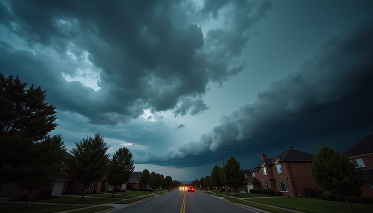
After 2 p.m., there is a 40% chance of showers and thunderstorms. These storms could bring brief heavy rain, but overall rainfall amounts will likely remain under a tenth of an inch, except in localized thunderstorm cells where heavier rain is possible.
What to Keep in Mind Today
Stay cool and hydrated: The heat index near 100°F can cause discomfort and heat-related illnesses.
Plan outdoor activities early: Morning hours will be sunnier and less humid.
Watch for sudden storms: Thunderstorms may develop quickly in the afternoon.
Tonight’s Outlook: Lingering Showers and Warm Temperatures
The chance of showers and thunderstorms continues into the night, mainly before 4 a.m., with a slight chance after 5 a.m. Temperatures will remain warm, dropping only to about 73°F. Winds will be light from the southwest at 3 to 5 mph. Rainfall amounts overnight are expected to be minimal, but thunderstorms could bring localized heavier rain.
Midweek Weather: More Heat and Afternoon Storms
Wednesday will bring another hot day with highs near 95°F and heat index values reaching up to 107°F. The west wind will pick up slightly, blowing between 3 and 7 mph. The chance of precipitation is 30%, mainly after 2 p.m., with scattered showers and thunderstorms possible.
Wednesday night will remain partly cloudy with a low near 73°F and a 30% chance of showers and thunderstorms before 8 p.m. Winds will be light and from the west.
Tips for Midweek
Avoid strenuous outdoor work during peak heat: The heat index above 100°F can be dangerous.
Keep an eye on weather alerts: Afternoon storms may bring lightning and brief heavy rain.
Prepare for humid nights: Warm temperatures will persist overnight.

Thursday and Beyond: Sunny, Hot, and Variable Rain Chances
Thursday will be sunny and hot again, with highs near 95°F. Winds will be calm in the morning but will increase to 5 to 9 mph from the west by midday. The night will be mostly clear with lows around 73°F.
Friday looks mostly sunny with a high near 91°F. However, a chance of showers and thunderstorms will return after 2 a.m. Friday night, with a 40% chance of precipitation and partly cloudy skies.
Independence Day Weather
The Fourth of July will feature a mix of sun and showers. There is a 50% chance of precipitation throughout the day, with showers and thunderstorms possible before 8 a.m., between 8 a.m. and 2 p.m., and again after 2 p.m. Temperatures will be slightly cooler, with a high near 89°F and partly sunny skies.
Saturday night may bring thunderstorms before 8 p.m., with a 30% chance of rain and partly cloudy skies. Sunday will be mostly sunny with a high near 88°F, but showers could return Sunday night with a 30% chance of precipitation and mostly cloudy skies.
Monday will continue the trend with a chance of showers and thunderstorms and a high near 87°F.

How to Prepare for This Week’s Weather
Stay hydrated and cool: High heat and humidity increase the risk of heat exhaustion.
Monitor weather updates: Thunderstorms can develop quickly and bring heavy rain or lightning.
Plan outdoor events carefully: Morning hours tend to be sunnier and less stormy.
Have rain gear ready: Keep umbrellas or rain jackets handy, especially in the afternoons and evenings.
Protect your home and property: Secure loose items that could be affected by wind or rain.


Comments