Winter Weather Forecast Snow Accumulation and Temperatures for the Week Ahead
- edu.plus.weatherray Rome
- Dec 14, 2025
- 3 min read

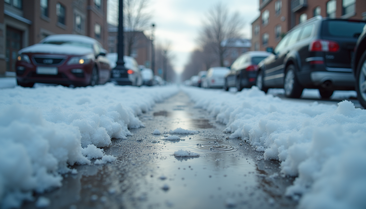
Winter weather is set to bring a mix of snow showers and fluctuating temperatures over the next several days. If you live in or plan to travel through the affected areas, understanding the forecast can help you prepare for changing road conditions and dress appropriately. This week’s weather will feature periods of snow accumulation, mostly cloudy skies, and a gradual warming trend toward the end of the week.

Snow Showers and Accumulation Through Monday
This afternoon, snow showers are likely, mainly before 4 p.m., with a 70% chance of precipitation. Temperatures will peak near 21°F, accompanied by northwest winds around 10 mph. Expect about an inch of snow accumulation during the daytime, which could make roads slick and require extra caution for drivers and pedestrians.
Tonight, snow showers will continue, mainly after 9 p.m., with lows dropping to around 7°F. Winds will ease slightly to 5 to 7 mph from the northwest. Another inch of snow accumulation is possible overnight, adding to the daytime total.
Monday will bring more snow showers, mainly after noon, with a 60% chance of precipitation. The high will rise slightly to near 26°F, and winds will shift to a calm start, becoming west at 5 to 8 mph by morning. Snow accumulation on Monday is expected to be less than one inch, but it will still contribute to slippery surfaces.
Monday night offers a chance of snow showers mainly between 2 a.m. and 5 a.m., with a 40% chance of precipitation. Temperatures will hold steady around 14°F, with southwest winds of 5 to 8 mph. Snow accumulation overnight will likely be less than half an inch.
Midweek Weather Brings Sunshine and Rising Temperatures
Tuesday looks to be the brightest day of the week, with mostly sunny skies and a high near 31°F. Winds will be calm in the morning, becoming southwest around 5 mph in the afternoon. This day offers a break from snow, allowing for safer travel and outdoor activities.
Tuesday night will be mostly cloudy with lows around 22°F. While no precipitation is expected, the cloud cover will keep temperatures from dropping too low.
On Wednesday, mostly cloudy skies will continue with a high near 40°F. This marks a significant warming trend compared to earlier in the week. The higher temperatures may cause some snow to melt, especially on roads and sidewalks.
Wednesday night will remain mostly cloudy with lows near 24°F, maintaining the milder conditions.
Late Week Rain and Snow Chances
Thursday will bring a chance of rain after 1 p.m., with a 40% chance of precipitation. The high temperature will reach near 46°F, the warmest of the week so far. Rainfall could cause some snow to melt quickly, potentially leading to wet and slippery surfaces.
Thursday night will see rain continuing, with a 100% chance of precipitation and lows around 34°F. This steady rain may lead to minor flooding in low-lying areas and further snow melt.
Friday is expected to have snow likely, with a 60% chance of precipitation and a high near 36°F. The snow may mix with rain at times due to the relatively mild temperature. This could create slushy conditions on roads and sidewalks.
Friday night will be mostly cloudy with lows around 14°F, allowing any wet surfaces to freeze overnight.
Saturday offers a chance of snow showers with a 40% chance of precipitation and a high near 36°F. The mix of snow and mild temperatures will keep conditions variable, so staying updated on the forecast will be important.

Preparing for the Week Ahead
With snow accumulation expected on multiple days and temperatures fluctuating between the single digits and mid-40s, preparation is key. Here are some practical tips to stay safe and comfortable:
Monitor local weather updates regularly for changes in snow and rain timing.
Allow extra travel time on days with snow showers, especially Monday and Friday.
Keep sidewalks and driveways clear to prevent ice buildup from melting and refreezing.
Dress in layers to adjust to the wide temperature range, from lows near 7°F to highs near 46°F.
Check vehicle readiness including tire tread and windshield wiper fluid for snow and rain conditions.


Comments