Winter Weather Forecast A Week of Snow Showers and Bitter Cold Ahead
- edu.plus.weatherray Rome
- Jan 19
- 3 min read

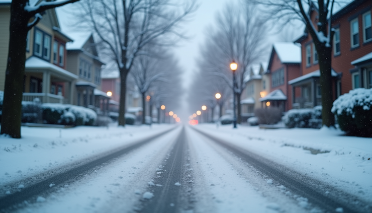
As Martin Luther King Jr. Day approaches, the weather is set to bring a challenging mix of snow showers and bitter cold temperatures. Residents should prepare for fluctuating conditions that could impact travel, outdoor plans, and daily routines. This week’s forecast shows a pattern of intermittent snow with temperatures often dipping below freezing, accompanied by strong winds that increase the chill factor. Understanding the details of this forecast can help you stay safe and comfortable during the coming days.
Monday: Snow Showers and Wind Gusts
Monday starts mostly cloudy with a chance of snow showers mainly after noon. The high temperature will reach near 27°F, but the wind will pick up from the south, shifting southwest in the morning with speeds between 9 and 14 mph. Gusts could reach as high as 25 mph, making it feel colder than the thermometer shows.
Chance of precipitation: 50%
Snow accumulation: Less than one inch during the day
These conditions mean roads could become slick in the afternoon, especially on untreated surfaces. If you plan to be outside, dress in layers and prepare for gusty winds that can reduce visibility and increase the cold.
Monday Night into Tuesday: Continued Snow and Cold
Snow showers will continue after midnight Monday night, with partly cloudy skies and a low around 11°F. Wind chill values could drop as low as -4°F due to west winds gusting up to 30 mph. Snow accumulation overnight is expected to be less than half an inch.
Tuesday will remain cold with a high near 17°F. Snow showers will be possible throughout the day, with wind chills dropping to -5°F at times. Winds will stay strong from the west, gusting near 29 mph.
Chance of precipitation Tuesday: 40%
Snow accumulation Tuesday: Less than half an inch
These conditions will make outdoor activities uncomfortable without proper winter gear. The strong winds combined with low temperatures can cause frostbite risk in exposed skin within minutes.
Midweek Outlook: Snow Showers Persist
Wednesday brings a chance of snow showers mainly after 1 pm, with mostly cloudy skies and a high near 30°F. Winds will shift to the south at 6 to 10 mph, with gusts up to 21 mph. The chance of precipitation remains at 50%.
Wednesday night will continue with mostly cloudy skies and a chance of snow showers, with lows around 24°F and a 40% chance of precipitation.

Late Week: Snow Showers Likely and Cold Temperatures
Thursday looks to be the snowiest day of the week, with snow showers likely throughout the day. The high will reach near 33°F, but the chance of precipitation is high at 70%. Snow accumulation could be more significant, so expect slippery roads and reduced visibility.
Thursday night will remain mostly cloudy with a chance of snow showers and a low near 12°F. The chance of precipitation drops to 30%, but cold temperatures will persist.
Friday continues the trend with a chance of snow showers and a high near 19°F. The chance of precipitation is 40%, and snow showers may continue into early Friday night before tapering off. Temperatures will drop to around -3°F overnight.
Weekend Preview: Cold and Mostly Cloudy
Saturday will be mostly cloudy and cold, with a high near 7°F. Overnight lows will dip to around -6°F, making it one of the coldest nights of the week.
Sunday offers some relief with partly sunny skies and a high near 12°F. While still cold, the sunshine will help make outdoor activities more bearable.

Preparing for the Week Ahead
This week’s forecast calls for frequent snow showers and bitter cold temperatures with strong winds that increase the chill factor. Here are some practical tips to stay safe and comfortable:
Dress in layers with insulated and windproof outerwear.
Limit outdoor exposure during the coldest parts of the day, especially when wind chills are below zero.
Check road conditions before traveling, as snow and ice can make driving hazardous.
Keep emergency supplies in your vehicle, including blankets, food, and water.
Protect pets and plants from the cold by bringing them indoors or providing shelter.
Staying informed about weather updates will help you adjust plans as needed. This winter weather pattern reminds us to respect the power of cold and snow and to prepare accordingly.


Comments