Weather Wonders: From Foggy Mornings to Thunderstorms Ahead
- edu.plus.weatherray Rome
- Aug 22, 2025
- 4 min read

As we step into the weekend, the weather forecast brings a blend of conditions that can affect our plans and activities. From early morning fog to the potential for thunderstorms later, understanding the weather helps us maximize our days. Let's jump into what to expect in the coming days.
A Foggy Start to the Day
Today begins with a touch of mystery as patchy fog blankets the area before 9 AM. This atmospheric occurrence can create a serene and tranquil landscape, but it also requires caution for those on the road. In fact, reduced visibility due to fog can diminish to as low as a quarter mile, making it critical to drive slowly and use headlights. As the sun rises, the fog will dissipate, leading to a sunny day with a high near 81 degrees.
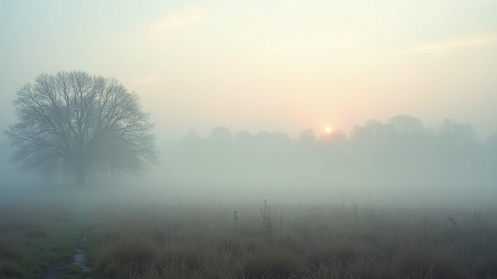
The light northwest wind will provide a gentle breeze, turning it into a perfect day for outdoor activities. Whether you're planning a morning jog or a leisurely stroll, those clear skies later in the day are sure to enhance your experience.
A Pleasant Evening Ahead
Tonight, conditions will remain mostly clear, with temperatures dropping to around 57 degrees. The calm wind creates a peaceful atmosphere, perfect for unwinding after a busy day.
Consider taking advantage of this pleasant weather. A backyard barbecue could be just the ticket, allowing you to enjoy the mild temperatures. Imagine gathering with family or friends, grilling burgers, and sharing laughs as the sun sets.

Saturday: A Warm and Sunny Day
As we look ahead to Saturday, expect mostly sunny skies with a high approaching 85 degrees. A southeast wind will strengthen, providing a refreshing breeze that makes the warmth more enjoyable.
This is an excellent time for outdoor activities. You might organize a picnic in the park, complete with sandwiches, fresh fruit, and refreshing drinks. Remember to stay hydrated. Drink water consistently, especially if you spend extended time outdoors.
Saturday Night: Thunderstorms on the Horizon
As sunset approaches on Saturday, prepare for a shift in weather. There is a significant chance of showers and thunderstorms, especially after 2 AM. The skies will turn mostly cloudy, and temperatures will fall to about 62 degrees.
With a 60% chance of precipitation, it is wise to keep up with the latest weather updates. If you have outdoor events planned, consider moving them indoors or at least prepare for some rain. Historical data shows that summer thunderstorms can produce rainfall amounts between 1-2 inches in a short duration, leading to localized flooding.

Sunday: A Rainy Day Ahead
Sunday is set to bring continued wet weather, with showers likely throughout the day. The forecast shows a strong chance of thunderstorms after 2 PM, with a high around 80 degrees.
With a 90% chance of rain, it is a perfect day to stay inside and enjoy cozy activities. You might consider binge-watching a favorite series, reading a book you’ve been wanting to tackle, or even trying out a new recipe. Cooking can be particularly satisfying on a rainy day, especially if you whip up a comforting dish like homemade soup or freshly baked cookies.
Sunday Night: More Showers Expected
Transitioning into Sunday night, expect the rain to persist, with overnight temperatures dropping to about 58 degrees. Given the 80% chance of showers, be prepared for wet conditions if you have plans.
This could be an excellent time to savor a warm drink and relax at home, listening to the soothing sound of rain tapping against the windows.
Monday: A Chance of Showers
As we kick off the new week, Monday will bring a chance of showers amid partly sunny skies. Expect a high around 75 degrees, with a 40% chance of precipitation.
This unpredictable weather can complicate planning a little. Keeping an umbrella nearby is a smart move to ensure you're ready for any sudden showers.
Monday Night: Clear Skies Ahead
On Monday night, we'll transition to partly cloudy skies, with temperatures dropping to around 52 degrees. This can be a lovely opportunity to enjoy cooler evening air, perhaps with a stroll or some stargazing if the clouds clear up.
Tuesday: More Showers Possible
Tuesday's forecast indicates a chance of showers again, with partly sunny conditions and a high near 70 degrees. The chance of precipitation remains at 40%, so it’s another day to stay prepared for changing weather.
Tuesday Night: A Cool Evening
As we move into Tuesday night, expect partly cloudy skies with a low around 50 degrees. This cooler weather can be refreshing, making it an ideal evening for a quiet night at home.
Wednesday: A Return to Sunshine
By Wednesday, the weather is predicted to improve significantly, showcasing mostly sunny skies with a high around 69 degrees. After several days of rain, this change in weather is a welcome relief, providing a perfect chance to enjoy the great outdoors.
Wednesday Night: Clear and Cool
Wednesday night will offer mostly clear skies, with temperatures dipping to about 49 degrees. This creates an inviting atmosphere for a peaceful evening outdoors, perhaps around a fire pit or simply enjoying the calm of the night.
Thursday: Sunny and Pleasant
To wrap up the week, Thursday looks promising with sunny skies and a high near 75 degrees. This weather presents a fantastic opportunity to be outdoors, whether you want to play sports, go for a hike, or simply enjoy a walk in your neighborhood.
Embrace the Weather Changes
As we navigate this week’s weather, expect a range of conditions from foggy mornings to the risk of thunderstorms. Staying informed and prepared allows us to make the most of each day. Whether you embrace the sunshine or seek cozy activities during the rain, there are plenty of ways to enjoy the various weather wonders that come our way.


Comments