Warm Week Ahead Sunny Starts Then Weekend Storm Chances

A calm, warm stretch is setting up across Central New York, but the dry weather does not hold all weekend. The next few days bring a little of everything: early fog, sunshine, highs near 80, and then a more unsettled pattern with showers and thunderstorms from Saturday afternoon into Monday.
For Canastota and nearby communities, the best window for outdoor plans comes from late today through Friday night. Saturday starts usable too, but storm chances rise after 2 p.m. By Sunday, wet weather looks much more likely, with showers and a possible thunderstorm in the forecast.
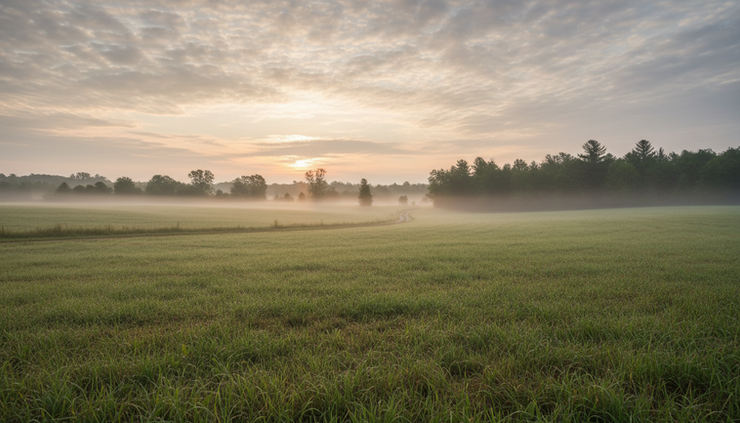
The week starts warm with a quiet Friday ahead
Today begins with patchy fog before 9 a.m., especially in low-lying areas, near open fields, and around sheltered rural roads. Once the fog lifts, the day turns mostly cloudy rather than bright, but temperatures still climb to a comfortable high near 77 degrees.
Winds stay light out of the west. That matters because light wind can allow fog to linger for a bit in the morning, but it also keeps the afternoon feeling mild and easy. There is no major wind concern today.
Tonight looks pleasant and cooler. Skies become mostly clear, the wind goes calm, and the low drops to around 50 degrees. That is cool enough for a jacket after sunset, especially away from larger villages and near open countryside where temperatures can dip quickly under clear skies.
Friday brings one of the best days of the forecast. Sunshine returns, winds stay calm, and the high reaches near 81 degrees. The day should feel warm but not harsh, with dry weather holding through the evening.
Friday night remains mostly clear with a low near 56 degrees. Light and variable winds should make for a quiet night. If there are evening games, walks, backyard dinners, or travel plans, Friday evening looks like the cleanest and most comfortable part of the week.
Here is the short version of the early stretch:
Period | Sky and weather | Temperature | Wind |
Today | Patchy fog early, then mostly cloudy | High near 77 | Light west wind |
Tonight | Mostly clear | Low around 50 | Calm |
Friday | Sunny | High near 81 | Calm |
Friday night | Mostly clear | Low around 56 | Light and variable |
The main takeaway is simple: use Thursday evening and Friday if dry weather matters most. The warmth is already in place, and the rain risk stays low until the weekend pattern begins to change.
Saturday is the transition day
Saturday starts out partly sunny and warm, with a high near 81 degrees. A light southeast wind around 3 to 6 mph should not cause many issues. The change comes later in the day, when showers and thunderstorms become possible after 2 p.m.
The chance of precipitation is 50% Saturday afternoon and evening. That does not mean everyone sees rain at the same time. It means the atmosphere supports scattered showers and storms, and enough of the area has a real chance of getting wet.
For practical planning, Saturday is split into two very different parts.
The better window comes in the morning through early afternoon. Yard work, errands, youth sports, farmers market stops, and outdoor chores will have a better shot before the storm chance rises.
After midafternoon, plans need more flexibility. Thunderstorms can develop quickly in warm air, and they can turn a mostly fine day into a wet one with little warning. If outdoor plans stretch into the evening, keep a backup plan nearby.

Saturday night looks more unsettled. Showers and thunderstorms become likely, with mostly cloudy skies and a low around 59 degrees. The chance of precipitation rises to 60%.
That is a mild night for Central New York, but it may also be damp. Open windows might not be the best plan if showers move through. Campers, boaters, and anyone with outdoor equipment should secure loose items and cover what needs to stay dry before evening.
A few smart Saturday planning tips:
Do outdoor work early
Mowing, gardening, and cleanup are better bets before afternoon storms have a chance to form.
Keep rain gear in the car
A dry start does not guarantee a dry finish.
Watch the sky after lunch
Building clouds, a sudden breeze, or distant thunder are signs to head indoors.
Have an indoor backup
This matters most for cookouts, graduation parties, and sports.
Sunday brings the highest rain chance of the stretch
Sunday carries the strongest signal for wet weather. The forecast calls for a chance of showers earlier, then showers and possibly a thunderstorm after 2 p.m. The high reaches near 79 degrees, so it will still feel warm and a bit humid at times, even with clouds and rain around.
The precipitation chance on Sunday is 80%, which makes it the wettest day in the forecast period. If Saturday is the transition day, Sunday is the main unsettled day.
This does not mean it rains every minute from morning to night. It does mean showers are likely enough that outdoor plans should be treated as weather-dependent. The best approach is to plan around wet ground, delays, and the possibility of thunder.
Sunday night stays active at first. Showers and possibly a thunderstorm are expected before 8 p.m., followed by a chance of showers between 8 p.m. and 2 a.m. The low falls to around 52 degrees, and the precipitation chance stays at 80%.
That evening drop into the lower 50s may feel cool after a damp day. If rain is still falling or surfaces are wet, the air can feel chillier than the number suggests. Keep a sweatshirt or light jacket handy if you need to be out after sunset.
The most weather-sensitive time of the week looks to be Saturday afternoon through Sunday night, with Sunday carrying the highest chance of showers and thunderstorms.
Thunderstorm days call for basic caution. If thunder is heard, move indoors. Open fields, water, metal bleachers, and isolated trees are not safe places to wait out lightning. Even a storm that does not look severe can still produce dangerous lightning.
Monday still looks unsettled before a nicer midweek rebound
Monday keeps a chance of showers in the forecast after 8 a.m. Skies turn partly sunny, and the high reaches near 75 degrees. The chance of precipitation is 50%, so the day is not a washout, but it is also not fully settled.
This type of Monday can be tricky. There may be long dry breaks, but a passing shower could still interrupt outdoor work, school activities, or travel. If the weekend rain leaves lawns and fields wet, Monday may also start with damp ground even where rain is not falling.
Monday night looks calmer, with partly cloudy skies and a low around 51 degrees. That marks the start of a more stable trend heading into Tuesday and Wednesday.
Tuesday brings mostly sunny skies and a high near 77 degrees. Tuesday night is partly cloudy with a low around 53 degrees. Wednesday looks mostly sunny and warmer again, with a high near 81 degrees.
That midweek rebound is useful if weekend jobs get delayed. Painting, mowing, planting, repairs, and outdoor cleanup may need to shift toward Tuesday or Wednesday if storms soak the ground.

The pattern is easy to summarize:
Day | Forecast focus | Best planning note |
Saturday | Warm, partly sunny, storms possible after 2 p.m. | Do outdoor plans early |
Saturday night | Showers and storms likely | Keep plans flexible |
Sunday | Showers likely, possible thunderstorm | Expect delays or wet conditions |
Sunday night | Showers and thunder early, then tapering | Damp and cooler late |
Monday | Chance of showers after 8 a.m. | Improving, but not fully dry |
Tuesday | Mostly sunny | Better outdoor window |
Wednesday | Mostly sunny and warm | Another strong outdoor day |
What this forecast means for everyday plans
This is not a cold or harsh pattern. Temperatures stay seasonable to warm, with highs mostly in the upper 70s to low 80s. The real issue is timing.
The dry stretch arrives first, then the storm risk builds over the weekend. That makes Friday the standout day, while Sunday is the day most likely to need adjustments.
Travel
Morning fog today could slow travel before 9 a.m., especially on rural roads and near low spots. Use low beams, leave extra space, and avoid sudden braking when visibility changes.
Weekend travel should account for wet roads and storms, especially late Saturday and Sunday. Heavy showers can reduce visibility quickly. If thunderstorm activity develops, brief downpours may make ponding possible in poor drainage spots.
Outdoor work
Friday is the best day for dry outdoor work. Saturday morning may also work, but projects that require several dry hours could get risky by afternoon.
If rain arrives Saturday night into Sunday, lawns and gardens may stay wet into Monday. Tuesday and Wednesday look better for anything that needs drier ground.
Sports and events
Friday looks favorable for evening events. Saturday needs a weather watch after lunch. Sunday is the highest-risk day for delays, postponements, or indoor moves.
For events with tents, sound equipment, grills, or temporary setups, plan ahead. Secure loose items before storms arrive, and avoid waiting until rain is already falling.
Gardens and yards
The warm temperatures help gardens, but thunderstorms can bring bursts of heavy rain. Check containers and low spots after the weekend rain. Make sure pots drain well, and avoid working compacted soil while it is soaked.
New plantings may appreciate the rain, but strong downpours can wash mulch or expose roots. A quick check after showers pass can prevent small issues from becoming bigger ones.
The warm pattern stays, but the weekend needs attention
The forecast does not show a sharp cool-down. Highs stay near 77 today, near 81 on Friday, near 81 again Saturday, near 79 Sunday, then settle around 75 Monday before climbing back toward the upper 70s and low 80s by midweek.
That steady warmth is one of the main themes. The other is the weekend storm chance. The shift from calm and sunny Friday to unsettled Saturday night and Sunday is the part to plan around.

If there is one sentence to carry through the next several days, it is this: enjoy the sunny start, but build flexibility into the weekend.
Friday is the clean pick for outdoor plans. Saturday is workable early, then turns more uncertain. Sunday looks wettest, with showers and a possible thunderstorm likely enough to affect plans. By Tuesday and Wednesday, the pattern turns brighter again, giving Central New York a warm finish after a stormy weekend stretch.


Comments