Sunshine, Morning Fog, and Weekend Showers Ahead

The next few days bring the kind of early-fall weather that makes Central New York mornings feel quiet and damp, then turns the afternoon bright and mild. Fog will be the main issue early in the day, especially in low spots, valleys, and areas near creeks or open fields. Once it burns off, sunshine takes over with highs near 70°F through Saturday.
The larger pattern is simple: pleasant days now, cooler clear nights, then a wetter stretch arriving Saturday night into Sunday. The weekend does not look like a washout from start to finish, but showers become more likely as Saturday turns into Saturday night and Sunday.
For Madison County and nearby parts of Central New York, that means good weather for outdoor work, errands, school events, and leaf-peeping through Saturday afternoon, with a better reason to keep rain gear nearby later in the weekend.

The short version of the forecast
The forecast holds onto a steady theme for the next several days. Mornings start cool and foggy in some spots. Afternoons warm into the upper 60s to near 70°F. Nights stay clear to partly cloudy, with lows mainly in the 40s to around 50°F.
The main change comes late Saturday. Clouds increase, and showers become possible Saturday night. Shower chances continue into Sunday, then ease Sunday night. Early next week turns quieter again, with partly sunny to mostly sunny skies and a warming trend by Wednesday.
Period | Expected conditions | High or low | Wind | Rain chance |
Today | Patchy fog before 8 a.m., then sunny | High near 70°F | Light northeast | Low |
Tonight | Mostly clear | Low near 42°F | Calm | Low |
Friday | Patchy fog before 9 a.m., then sunny | High near 70°F | Calm, then northwest near 5 mph | Low |
Friday Night | Mostly clear | Low near 48°F | North near 5 mph, then calm | Low |
Saturday | Areas of fog before 9 a.m., then partly sunny | High near 70°F | North 5 to 8 mph | Low during the day |
Saturday Night | Mostly cloudy with a chance of showers | Low near 49°F | Light | 40% |
Sunday | Chance of showers, partly sunny | High near 66°F | Light | 50% |
Sunday Night | Chance of showers before 2 a.m., mostly cloudy | Low near 50°F | Light | 30% |
Monday | Partly sunny | High near 66°F | Light | Low |
Tuesday | Mostly sunny | High near 69°F | Light | Low |
Wednesday | Mostly sunny | High near 74°F | Light | Low |
The table tells the story well. The clearest stretch runs from today through Friday night. Saturday starts dry for most places, but the odds of showers climb after sunset. Sunday is the day most likely to require a backup plan for outdoor activities.
Fog will shape the morning drive
Patchy fog is expected today before 8 a.m., Friday before 9 a.m., and again Saturday before 9 a.m. This does not mean every road will be socked in. Fog often forms unevenly in Central New York, especially when nights are clear, winds are light, and temperatures drop close to the dew point.
That setup is in place during this forecast. Calm or nearly calm winds overnight allow cooler air to settle into low areas. Moisture near the ground condenses into fog, especially around:
Creek valleys
Farm fields
Low-lying roads
Open rural stretches
Areas near small ponds, wetlands, or wooded hollows
Visibility can change quickly. One hilltop may be clear while the next dip in the road turns gray and soft around the edges. That is common across Madison County, where elevation changes can make a short drive feel like moving between two different weather zones.
The good news is that the fog should be mostly a morning issue. Once the sun gets higher, the surface warms and the fog thins out. By late morning, most areas should see much better visibility and a bright, mild day.
A few simple habits help on foggy mornings:
Use low beams, not high beams.
Leave extra room between vehicles.
Slow down before dips in the road.
Watch for school buses, farm equipment, and people walking near road edges.
Give yourself extra time if travel starts before 9 a.m.
Fog can look harmless from the kitchen window, but it can feel very different behind the wheel. The thickest patches often sit exactly where the road drops into a valley or crosses open fields.
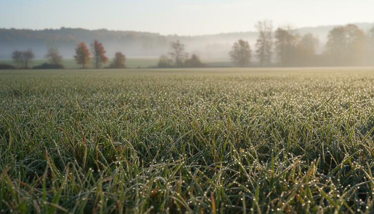
Sunny afternoons will feel mild and comfortable
After the fog clears, today and Friday look bright and pleasant. Highs near 70°F are mild for the season and comfortable for outdoor plans. Winds stay light, which should make the afternoons feel even better.
Today brings sunshine with a high near 70°F and a light northeast wind. Tonight turns mostly clear, with the temperature dropping to around 42°F. That is cool enough for a jacket after sunset and may feel chilly in sheltered rural spots.
Friday follows a similar pattern. Morning fog gives way to sun, and the high again reaches near 70°F. The wind stays calm early, then turns northwest around 5 mph in the afternoon. Friday night remains mostly clear, with a low around 48°F. A light north wind may become calm during the evening.
These are good conditions for tasks that need dry weather:
Mowing or raking leaves
Outdoor school sports
Farm and garden cleanup
Walking local trails
Washing vehicles
Setting up weekend events
Covering or moving items before weekend showers arrive
The dry air and clear nights also mean temperatures can fall quickly once the sun sets. A mild afternoon near 70°F can turn into a cool evening in the 40s before long. Layers will be useful, especially for anyone staying out after sunset.
For homes without the heat on yet, the cool nights may also make mornings feel brisk indoors. Opening windows during the warmest part of the day can help freshen the house, but closing them before sunset will keep the chill from settling in.
Saturday starts useful, then clouds build
Saturday is the transition day. The morning starts with areas of fog before 9 a.m., then the sky becomes partly sunny. The high should reach near 70°F again, so the first half of the day still looks useful for outdoor plans.
Winds will be calm early, then turn north at 5 to 8 mph in the afternoon. That is not strong, but it may add a slightly cooler feel compared with the calm, sunny afternoons before it.
The key detail is timing. Saturday daytime looks more favorable than Saturday night. If there are outdoor chores or plans that need dry weather, earlier is better. By Saturday night, clouds increase and showers become possible. The chance of precipitation rises to 40%.
That does not guarantee rain at every location, but it does mean the pattern changes. A mostly cloudy sky and a low near 49°F will make the night feel damp, especially if showers pass through.
For weekend planning, Saturday is the better day for:
Morning errands
Outdoor sports
Yard cleanup
Local drives
Farmers market stops
Early leaf-viewing plans
Any task involving dry pavement, dry grass, or open windows
By late day, it makes sense to bring cushions inside, cover firewood, close garage windows, and check anything that should not get wet overnight.

Sunday brings the best chance for showers
Sunday is the unsettled part of the forecast. Showers are possible, and the chance of precipitation rises to 50%. The sky should be partly sunny at times, but the day carries enough rain potential to make outdoor plans less certain.
The high near 66°F will be cooler than the stretch before it. That is still mild, but clouds and showers can make it feel cooler, especially during damp periods. Sunday night keeps a chance of showers before 2 a.m., then trends mostly cloudy with a low around 50°F. Rain chances drop to 30% overnight.
This kind of setup often leads to an uneven day. Some places may see light showers. Other spots may stay dry for long stretches. The forecast does not point to an all-day soaking based on the information provided, but it does favor having a flexible plan.
For Sunday, plan around changeable conditions:
Keep a rain jacket in the car.
Expect damp grass and wet leaves.
Have an indoor backup for outdoor gatherings.
Check conditions before heading out for longer hikes or drives.
Allow extra time if roads are wet and leaves collect on pavement.
Wet leaves can be slick, especially on shaded roads, sidewalks, and driveways. Even a light shower can make them slippery. That matters on back roads, village streets, and walkways around homes and schools.
Sunday evening may still feel cloudy and damp, even after showers taper. The low near 50°F is not especially cold, but the moisture in the air can make it feel raw compared with the crisp, clear nights before it.
Next week looks quieter and warmer by Wednesday
After the weekend showers, the forecast settles down again. Monday starts the new workweek with partly sunny skies and a high near 66°F. Monday night turns partly cloudy, with a low around 48°F.
Tuesday looks brighter, with mostly sunny skies and a high near 69°F. Tuesday night is mostly clear, with a low around 49°F. By Wednesday, sunshine continues and temperatures climb to near 74°F.
That slow warming trend is a nice rebound after the cooler, showery Sunday. It also gives the ground some time to dry out after any weekend rain. If Sunday interrupts outdoor plans, Monday through Wednesday may offer another window.
Early next week should be favorable for:
Raking after leaves dry
Fall garden work
Short hikes and walks
Outdoor repairs
School and sports travel
Drying damp outdoor gear from the weekend
The main difference from the end of this week may be fewer fog mentions in the forecast. That does not mean fog will be impossible, since Central New York can produce patchy fog under the right overnight conditions. It does mean the forecast highlights fog most clearly through Saturday morning.

What this means for Central New York plans
The best stretch for dry, bright weather runs from today through Saturday afternoon. If the main goal is sunshine, mild air, and low rain risk, that is the window to use. Morning fog may briefly slow things down, but the afternoons look friendly.
The highest rain risk arrives Saturday night into Sunday. Showers may not last the whole time, but the weekend forecast turns less dependable once clouds thicken late Saturday. Sunday is the day to treat as flexible.
Here is the practical breakdown:
Best outdoor window
Today through Saturday afternoon, after morning fog clears.
Coolest night
Tonight, with a low near 42°F.
Foggiest mornings
Today, Friday, and Saturday before 8 or 9 a.m.
Best chance of showers
Sunday, with a 50% chance.
Warmest day in the extended outlook
Wednesday, with a high near 74°F.
For most of the area, the forecast is more helpful than disruptive. The fog is short-lived. The sunshine is steady. The rain chances arrive mainly during a defined weekend window. That gives plenty of room to plan, as long as Sunday plans can bend a little.
The takeaway is simple: enjoy the mild sunshine while it holds, drive carefully through the foggy mornings, and keep the umbrella handy once Saturday night arrives. By early next week, quieter weather returns, and Wednesday could feel pleasantly warm again for Central New York.


Comments