Sunny Start, Foggy Mornings, and a Wet Weekend Ahead

Central New York gets a pleasant opening stretch, but the pattern turns more unsettled by the weekend. The next several days bring a little bit of everything: bright afternoons, cool nights, early fog, a warmer Saturday, and increasing shower chances from Saturday night into Sunday.
For Madison County and nearby areas, the main takeaways are simple. Today and Friday look like the best outdoor days, early morning fog could slow the start in low-lying spots, and the weekend is not a washout, but it does come with a growing risk of showers.

The forecast starts bright and comfortable
Today brings mostly sunny skies and a high near 78 degrees. That is a comfortable late-season feel for Central New York, warm enough for outdoor work, errands, sports practices, and evening walks, but not hot enough to feel oppressive.
The one thing to notice today is the wind. A west wind around 8 to 11 mph will be noticeable at times, with gusts as high as 25 mph. That kind of breeze can move loose patio items, dry out lawns and gardens a bit faster, and make open fields feel cooler than sheltered spots.
If you are planning yardwork, a bike ride, or time on the water, the sunshine is helpful, but those gusts matter. Open hills, lakeshores, and exposed roads may feel breezier than village centers or wooded neighborhoods.
Tonight stays partly cloudy with a low near 51 degrees. Wind from the west around 5 mph should become calm in the evening. That lighter wind, combined with cooling overnight temperatures, sets the stage for patchy fog toward daybreak.
The fog risk is not all night. It is expected mainly after 5 a.m., which means the pre-dawn and early commute window may be the time to watch. Valleys, fields, streams, and low spots often see fog first. Roads can look clear in one town and turn hazy a mile or two later.
The best stretch for dependable sunshine comes today and Friday, before shower chances begin to build over the weekend.
Friday keeps the fair weather going. Patchy fog may linger before 8 a.m., then skies turn sunny with a high near 73 degrees. Winds stay light early, then become northwest at 5 to 7 mph in the afternoon.
Friday night looks quiet and clear, with a low around 49 degrees and calm wind. It will be a crisp night, especially in rural pockets where temperatures can feel cooler after sunset.
Fog may affect the early mornings
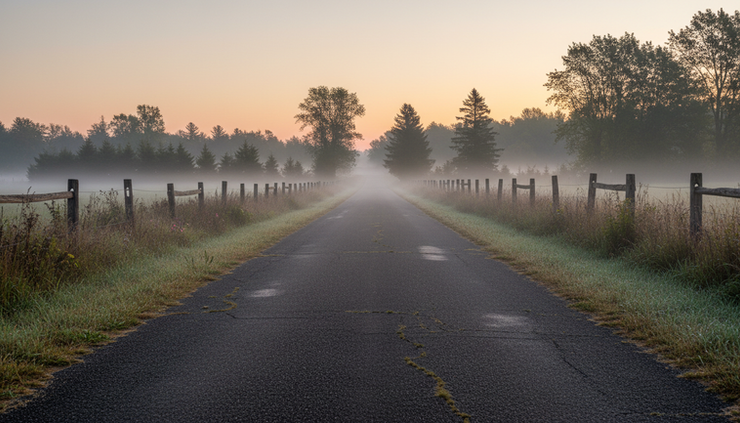
The forecast mentions patchy fog two mornings in a row: late tonight into early Friday, then again before 8 a.m. Friday. That is common when skies partially clear, winds go calm, and temperatures drop close to the dew point.
Fog is usually most noticeable in places where cool air settles. Around Madison County, that can include valleys, farm fields, areas near creeks, and stretches of road bordered by open land. It may not cover every town, and it can change quickly over short distances.
For drivers, the main concern is visibility. Fog can make headlights and brake lights harder to judge, especially just before sunrise. If fog forms, leave extra space, use low-beam headlights, and avoid sudden lane changes. High beams tend to reflect off fog and can make visibility worse.
The fog should not dominate the day. Once the sun gets higher and mixing begins, visibility should improve. By midmorning Friday, the weather looks bright and mild.
Here is the simple morning outlook:
Time period | Main concern | What to expect |
Late tonight | Patchy fog after 5 a.m. | Partly cloudy, turning calm and cool |
Friday morning | Patchy fog before 8 a.m. | Fog lifts, then sunny skies return |
Friday afternoon | Pleasant weather | Sunny, high near 73, light northwest wind |
Friday night | Chilly and clear | Low near 49 with calm wind |
This is a good setup for anyone trying to fit in outdoor plans before the weekend becomes less predictable. Friday afternoon and evening look especially useful for mowing, school games, walking trails, or setting up for weekend events.
Saturday begins mild, then shower chances increase
Saturday starts as the transition day. It should be mostly sunny for a good part of the day, with a high near 80 degrees. Winds turn from the south at 3 to 7 mph, which helps pull in a warmer and more humid feel compared with Friday.
A slight chance of showers arrives after 2 p.m., with the chance of precipitation at 20%. That does not mean rain is likely for everyone. It means most of the day can still be usable, but a stray shower could pop up later.
For planning purposes, Saturday morning into early afternoon looks like the better window. If there are outdoor markets, youth sports, lawn projects, or travel around the region, try to get the most weather-sensitive tasks done early.
Saturday night brings a more noticeable change. Showers become more likely, mainly after 8 p.m., with a 50% chance of precipitation. Clouds increase, and the low only drops to around 64 degrees. That is much milder than the previous nights and a sign that more moisture is moving into the area.
A low in the 60s after two nights near 50 will feel different. It may be more humid, and windows left open during the day may not cool the house as quickly overnight. It is also a good reminder to bring in cushions, cover outdoor furniture, and check anything left in the yard if rain moves through.
Sunday remains unsettled. The forecast calls for a chance of showers, mostly cloudy skies, and a high near 80 degrees. The chance of precipitation stays at 50%.
That does not guarantee steady rain all day. Showery patterns often come in waves, with dry breaks in between. The sky may stay mostly cloudy even when rain is not falling. If plans are flexible, keep a backup option ready.

A quick breakdown for the weekend:
Day | Sky | High and low | Rain chance |
Saturday | Mostly sunny, then slight shower chance after 2 p.m. | High near 80 | 20% |
Saturday night | Mostly cloudy, showers possible mainly after 8 p.m. | Low around 64 | 50% |
Sunday | Mostly cloudy with a chance of showers | High near 80 | 50% |
Sunday night | Mostly cloudy | Low around 56 | Not specified |
The weekend message is not “stay inside.” It is more practical than that. Use Saturday’s early hours wisely, then keep an eye on the sky from late afternoon through Sunday.
Early next week brings a brief break before more rain
The pattern eases a bit on Monday. Expect partly sunny skies and a high near 74 degrees. That is cooler than the weekend, and it should feel more comfortable after the clouds and shower chances on Sunday.
Monday night turns partly cloudy with a low around 58 degrees. It is not as crisp as Friday night, but it is still reasonably mild for sleeping and early morning routines.
Tuesday warms up again, with a high near 83 degrees and mostly sunny skies. Shower chances return during the day at 40%. That makes Tuesday a mixed day, warm and bright at times, but with enough instability or moisture around to support some showers.
Tuesday night has the highest rain chance in this stretch. Showers are likely, with a 70% chance of precipitation and a low around 59 degrees. If you have midweek travel, late practices, or outdoor evening plans, Tuesday night is the period that calls for the closest attention.
Wednesday stays a little unsettled, with a 30% chance of showers, partly sunny skies, and a high near 73 degrees. That suggests the system may still be nearby or exiting, leaving behind cooler temperatures and leftover shower chances.
Here is the extended view:
Period | Forecast | Temperature |
Monday | Partly sunny | High near 74 |
Monday night | Partly cloudy | Low around 58 |
Tuesday | Mostly sunny, chance of showers | High near 83 |
Tuesday night | Showers likely | Low around 59 |
Wednesday | Partly sunny, chance of showers | High near 73 |
This is a typical back-and-forth stretch for Central New York. Dry air wins for a couple of days, moisture returns for the weekend, then another round of showers becomes possible early next week.
How to plan around the changing weather
The next several days are not severe on paper, but they do require a little planning. The biggest changes are timing, visibility, and rain chances.
For outdoor projects, aim for today and Friday. Both days offer sunshine, comfortable temperatures, and lower rain concerns. Today is warmer and breezier. Friday is a bit cooler, calmer, and likely very pleasant once morning fog clears.
For travel, watch the early fog risk. Most main roads should be manageable, but fog can reduce visibility fast in rural stretches. This matters for school commutes, farm travel, delivery routes, and anyone leaving before sunrise.
For weekend events, Saturday is the safer day, especially before midafternoon. Conditions should be warm and mostly sunny early, then shower chances increase later. Saturday night and Sunday carry higher rain chances, so tents, rain jackets, and indoor backup plans make sense.
For gardeners and homeowners, the rain chances may help dry lawns and gardens that need moisture. Still, scattered showers do not always deliver the same amount everywhere. One town may pick up a decent soaking while another only gets a brief sprinkle.
For fall-like comfort, Friday night is the cool standout with lows near 49. Saturday night is much milder near 64, so the air will feel more humid as the next weather system approaches.
A practical plan for the forecast:
Best outdoor window
Today through Friday evening, with Friday afternoon looking especially calm and bright.
Fog watch
Late tonight into early Friday morning, mainly in low-lying and rural areas.
Weekend rain risk
Low early Saturday, higher Saturday night and Sunday.
Warmest day
Tuesday, with a high near 83, though showers may develop.
Wettest period
Tuesday night, when showers are likely.
The headline for this stretch is balance. There is plenty of usable weather ahead, but the dry windows are not evenly spread out. The start is sunny and comfortable, the mornings turn briefly foggy, and the weekend leans wetter after Saturday afternoon.
If plans can shift, protect the early dry stretch. Get outdoor work done today or Friday, enjoy the mild Saturday start, and keep rain gear nearby from Saturday night into Sunday. By early next week, another break arrives before showers become likely again Tuesday night.


Comments