Sunny Days and Patchy Fog Ahead for the Coming Week

Central New York is heading into a quiet stretch of weather, and for late-season standards, it looks fairly comfortable. The main theme over the next several days is simple: plenty of sunshine, light winds, chilly nights, and a few rounds of patchy morning fog.
The days ahead should be good for outdoor errands, late yard cleanup, walks, and travel across Madison County and nearby parts of Central New York. Just keep an eye on visibility during the early morning hours, especially in lower spots, valleys, and areas near fields, streams, and wetlands.
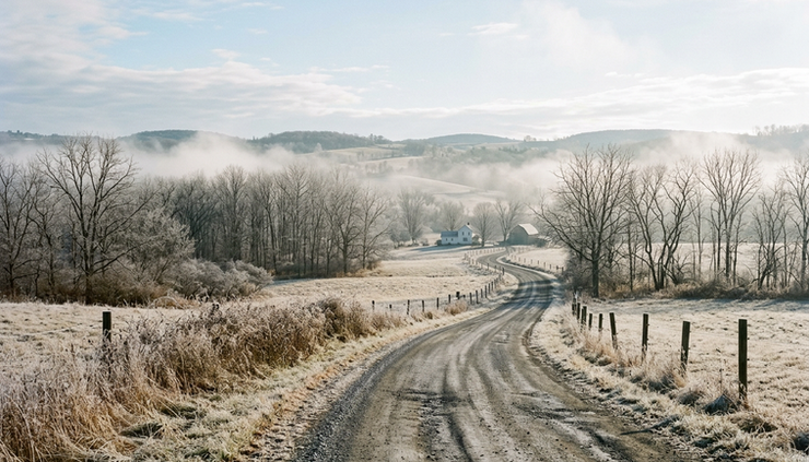
A calm and sunny pattern settles in
This afternoon brings a pleasant start to the forecast period. Skies stay sunny, with a high near 58 degrees. Winds remain light and variable, so it should feel mild in the sun. Without much wind, shaded areas may still feel cool, but overall this is one of the better afternoons of the week for outdoor plans.
Tonight stays clear for much of the evening, with temperatures falling to around 33 degrees. That is cold enough for frost in colder pockets, especially away from town centers and near open fields. Patchy fog may develop after midnight as the air cools and winds stay light.
That combination matters. Clear skies let heat escape from the ground quickly after sunset. Light wind allows colder, heavier air to settle into low-lying areas. When moisture is present near the surface, fog can form before sunrise.
For most places, this fog should be patchy rather than widespread. Still, even patchy fog can cause quick changes in visibility. A clear road can turn hazy within a short distance, especially in dips, valleys, and near water.
Thursday follows a similar pattern. Patchy fog may linger between 7 a.m. and 8 a.m., then the day turns mostly sunny with a high near 58. Winds should start calm before becoming northwest at 5 to 9 mph during the afternoon. That afternoon breeze will not be strong, but it may add a slightly cooler feel compared with calm sunshine.
The overall message for Thursday is favorable. After any early fog clears, the day looks dry, bright, and steady.
The coldest mornings arrive late in the week
Thursday night turns mostly clear, with patchy fog possible after 2 a.m. The low drops to around 30 degrees. A north wind around 5 mph should become calm in the evening, which again supports fog development in the usual cool spots.
Friday starts with patchy fog before 9 a.m., then becomes sunny. The high reaches near 54 degrees. That is a little cooler than Thursday, but still seasonable and pleasant under full sun. A light northwest wind continues the dry, quiet feel.
Friday night looks mostly clear, with a low around 29. That may be the coldest night of this forecast stretch. Anyone with sensitive outdoor items, late-season plants, or water lines in exposed areas should plan for a freeze.
This is also the part of the week when mornings may feel much colder than the afternoon forecast suggests. A high in the 50s can sound mild, but early temperatures near 30 require a warmer jacket, gloves for some, and extra time to clear frost from windshields.
Here is a quick look at the main forecast points:
Day | Expected conditions | High | Low |
This afternoon | Sunny, light wind | 58 | |
Tonight | Clear, patchy fog after midnight | 33 | |
Thursday | Early fog, then mostly sunny | 58 | 30 Thursday night |
Friday | Morning fog, then sunny | 54 | 29 Friday night |
Saturday | Sunny and clear | 59 | 32 Saturday night |
Sunday | Sunny, then partly cloudy at night | 63 | 41 Sunday night |
Monday | Mostly sunny, then mostly cloudy at night | 63 | 39 Monday night |
Tuesday | Mostly sunny | 56 |
The key detail is the sharp day-to-night temperature swing. Afternoon highs climb into the 50s and lower 60s, while overnight lows fall into the upper 20s and 30s. That is classic clear-weather cooling, and it often brings frost and fog in Central New York.
The weekend looks bright and more comfortable
The weekend brings the best stretch for outdoor plans. Saturday looks sunny with a high near 59. Saturday night stays clear, with a low around 32. That means another chilly start is likely, but the afternoon should recover nicely.
Sunday looks even milder, with sunshine and a high near 63. For many spots, that may be the warmest day of the week. Winds are not highlighted as a major issue, so the day should feel comfortable, especially during the afternoon.
Sunday night turns partly cloudy, with a low around 41. That is noticeably milder than the nights before it. More cloud cover can act like a blanket, slowing the loss of heat overnight. A low in the lower 40s also lowers the chance of widespread frost compared with Friday night or Saturday night.
For weekend planning, Saturday morning may start cold, but Saturday afternoon and Sunday both look favorable. Good uses for this stretch include:
Raking leaves or finishing yard cleanup
Taking a longer walk or hike
Washing vehicles before colder weather returns
Visiting farm stands or local outdoor markets
Traveling during daylight hours while roads are dry
The best time for outdoor comfort will likely be late morning through midafternoon. Early morning may still bring frost, damp surfaces, or a few areas of shallow fog.
Fog could be the only real travel issue
This forecast does not include rain, snow, strong wind, or major storms. That makes it a quiet stretch, but fog deserves respect because it changes conditions quickly.
Patchy fog is expected at times after midnight and during the early morning hours, especially tonight, Thursday night, and early Friday. Thursday morning may see fog between 7 a.m. and 8 a.m., while Friday morning may keep fog around before 9 a.m.
Fog risk often varies mile by mile. In Madison County and across Central New York, terrain plays a big role. Valleys, farm fields, low crossings, and areas near lakes, ponds, creeks, and marshy ground tend to fog up more easily than hilltops or open, breezy areas.
If driving during the fog window, use simple habits:
Slow down before visibility drops, not after
Use low-beam headlights
Leave more space between vehicles
Watch for school buses, farm vehicles, cyclists, and pedestrians
Be careful on bridges and shaded roads if temperatures are near freezing
Avoid using high beams in fog. They can reflect off the moisture in the air and make it harder to see.
Fog should improve after sunrise as the ground warms and mixing increases. Once it clears, the weather turns bright and dry again.
Early next week stays mostly quiet
Monday continues the mild, dry theme. Skies should be mostly sunny, with a high near 63. That gives Central New York another pleasant day before a slight step down in temperatures arrives Tuesday.
Monday night turns mostly cloudy, with a low around 39. That is still chilly, but not as cold as the late-week nights. Cloud cover should help keep readings up compared with the clear nights in the upper 20s and lower 30s.
Tuesday stays mostly sunny, with a high near 56. That is cooler than Sunday and Monday, but still comfortable for this time of year. No major weather system appears in this forecast period, and there is no mention of precipitation.
The pattern favors dry roads, good daylight visibility after morning fog clears, and manageable temperatures. The main adjustment is dressing for two different seasons in the same day. Mornings may feel wintry, while afternoons lean mild and springlike.
A smart clothing plan this week is simple:
Start with a warm layer in the morning
Keep sunglasses handy for bright afternoons
Wear shoes that can handle damp grass or frost
Keep a jacket nearby after sunset, when temperatures fall quickly


Comments