Stormy Start, Sunny Finish: Weekly Weather Outlook

Scattered storms will open the week, with the wettest stretch expected Tuesday into Wednesday before sunshine returns by Friday and Saturday. The latest forecast calls for several rounds of showers and thunderstorms, areas of early fog, and highs mostly in the upper 70s to mid-80s.
The main weather concern comes during the middle of the week, when rain chances rise sharply and storms could produce locally heavier downpours. Rainfall totals outside thunderstorms should stay light at times, but any stronger cell may briefly change conditions on roads, fields, and outdoor work sites.
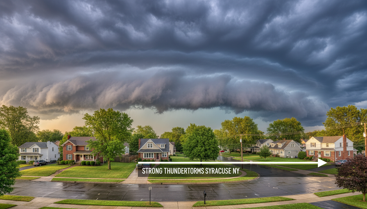
Storm chances continue through Sunday evening
This afternoon brings a mixed sky, with partly sunny conditions and scattered showers and thunderstorms. The high should reach near 82 degrees, with calm wind making the air feel still and humid when showers are not falling.
The chance of precipitation stands at 50 percent. Most locations that see rain should receive less than a tenth of an inch, but thunderstorms may produce higher amounts in a short time.
That split matters. A location that stays between cells may only see cloudy skies and damp pavement. A nearby neighborhood under a thunderstorm could see a quick downpour, brief ponding on roads, and reduced visibility.
Storms remain possible into the evening, mainly before 8 p.m. After that, the night turns partly cloudy. Lows should settle around 61 degrees, with calm wind continuing.
Areas of fog may develop after 3 a.m. Monday. Fog is most likely in low-lying spots, valleys, and areas that receive rain earlier in the day. Drivers early Monday should plan for patchy visibility changes, especially before sunrise.
Monday brings a brief break before late-day storms
Monday starts with areas of fog before 7 a.m., then turns mostly sunny. The afternoon should feel warmer, with a high near 84 degrees and light, variable wind.
The best chance for showers and thunderstorms comes mainly between 3 p.m. and 5 p.m. Rain chances are lower than Sunday, at 30 percent, but storms could still interrupt late-afternoon plans.
New rainfall amounts should again stay under a tenth of an inch for many locations. Thunderstorms remain the exception, with locally higher amounts possible under stronger cells.
The timing places Monday’s storm risk near the late school, work, and commute window. Outdoor practices, errands, and evening setup work may need a quick backup plan, even though much of the day looks dry.
Monday night then turns quiet. Skies stay partly cloudy, with a low around 63 degrees. Light and variable wind should continue.

Tuesday is the week’s wettest turning point
Tuesday marks a clear shift toward a wetter pattern. Showers and thunderstorms are likely early, then showers and possibly a thunderstorm become more widespread after 11 a.m.
The chance of precipitation rises to 90 percent, the highest daytime rain probability in the outlook. The high should reach near 80 degrees, with a south wind at 3 to 6 mph.
That wind is not strong, but the southerly flow can help feed moisture into the area. With such a high rain chance, Tuesday looks like the day most likely to disrupt outdoor work, recreation, and travel.
The forecast points to showers and possibly a thunderstorm continuing Tuesday night. The low should fall to around 61 degrees, and the chance of precipitation stays high at 80 percent.
Repeated rain through Tuesday and Tuesday night may leave lawns, trails, and unpaved surfaces soggy. Urban roads could also see brief drainage issues during heavier bursts, especially where storm drains are blocked by debris.
The main message for Tuesday is simple: keep rain gear close and expect wet weather to be part of the day rather than a brief interruption.
Wednesday stays unsettled and cooler
Showers continue Wednesday, with thunderstorms also possible after 2 p.m. The high should reach near 75 degrees, making it one of the cooler days of the forecast period.
Rain chances remain elevated at 80 percent. With clouds and showers around, Wednesday will likely feel damp and slower to warm.
By Wednesday night, showers remain likely. A thunderstorm is possible before 8 p.m., followed by showers likely between 8 p.m. and 2 a.m. Skies should stay mostly cloudy, with a low around 60 degrees.
The precipitation chance Wednesday night drops to 60 percent, but that still points to an unsettled evening. Plans that depend on dry ground or clear skies may need flexibility.
The cooler high near 75 will offer a break from the warmer feel early in the week. Still, the comfort may come with damp conditions and lingering clouds.
Thursday begins the transition to drier weather
Thursday does not look completely dry, but it begins the improvement trend. The day should be partly sunny, with a high near 79 degrees.
A chance of showers and thunderstorms returns after 2 p.m., with precipitation chances at 40 percent. That means scattered activity is possible, but the day should not be as wet as Tuesday or Wednesday.
Thursday night brings a chance of showers and thunderstorms before 8 p.m. After that, skies turn partly cloudy. The low should be near 60 degrees, with rain chances falling to 30 percent.
The late-day storm timing keeps afternoon and early evening plans somewhat exposed. Still, the lower rain chances suggest more dry time than the middle of the week.
This type of transition day can feel uneven. Some areas may see a brief storm. Others may simply see clouds building and fading. By night, the pattern should start to settle down.
Friday and Saturday bring the best outdoor window
Friday is the standout day in the forecast. Sunshine returns, with a high near 83 degrees.
Friday night should be partly cloudy, with a low around 62 degrees. No rain chance is listed for the period, making Friday the most reliable dry day after several unsettled rounds.
Saturday continues the improvement. Mostly sunny skies are expected, with a high near 85 degrees.
That makes the end of the week the best window for mowing, field work, outdoor gatherings, travel, and events that need a better shot at dry weather. Conditions will also feel warmer again, but without the same storm signal seen earlier in the forecast.
The sunny finish does not erase the wet start, especially if Tuesday and Wednesday bring repeated showers. Grounds may still be damp in shaded or low-lying areas. Even so, Friday and Saturday offer the clearest stretch of the week.
Day-by-day forecast summary
Day | Forecast | High | Low | Rain chance |
Sunday afternoon | Scattered showers and thunderstorms, partly sunny | 82 | 61 tonight | 50 percent |
Sunday night | Scattered storms before 8 p.m., fog after 3 a.m. | 61 | 30 percent | |
Monday | Morning fog, mostly sunny, late-day scattered storms | 84 | 63 Monday night | 30 percent |
Tuesday | Showers and thunderstorms likely, wetter after 11 a.m. | 80 | 61 Tuesday night | 90 percent |
Wednesday | Showers, storms possible after 2 p.m. | 75 | 60 Wednesday night | 80 percent |
Thursday | Partly sunny, chance of afternoon storms | 79 | 60 Thursday night | 40 percent |
Friday | Sunny | 83 | 62 Friday night | Not listed |
Saturday | Mostly sunny | 85 | Not listed |
What to watch this week
The forecast does not point to a single severe weather detail, but thunderstorms can still bring quick hazards. The most likely issues are brief heavy rain, changing visibility, wet roads, and lightning.
The periods most worth watching are:
Sunday afternoon and early evening
Scattered storms may develop with brief downpours.
Monday from 3 p.m. to 5 p.m.
A smaller storm chance lines up with the late-day travel window.
Tuesday through Wednesday
This is the wettest stretch, with the highest rain probabilities.
Thursday afternoon
A few showers or storms may linger before drier weather arrives.
Fog is also part of the early-week forecast. Late-night and early-morning fog can develop after rainfall when air is calm and temperatures cool. The forecast highlights fog after 3 a.m. tonight and before 7 a.m. Monday.
Drivers should slow down in fog, use low-beam headlights, and leave extra following distance. Visibility can change quickly over short distances.

The week ends on a much calmer note
The weather pattern starts unsettled, peaks in rain coverage Tuesday and Wednesday, then improves late Thursday into Friday and Saturday. Highs stay seasonable, ranging from the mid-70s during the wettest stretch to the mid-80s by Saturday.
The practical takeaway is to plan around the middle of the week. Tuesday and Wednesday carry the best chance for widespread wet weather, while Friday and Saturday offer the most dependable dry stretch.
For now, the forecast favors a stormy start and sunny finish, with the best outdoor window arriving just in time for the end of the week.


Comments