Stormy Start, Foggy Nights and a Sunny Stretch Ahead

Central New York gets a little bit of everything over the next several days: a stormy start, patchy overnight fog, two bright late-week days, and another unsettled turn by the weekend. The pattern is not extreme, but it is changeable enough to affect commutes, outdoor work, evening plans, and weekend timing.
The main theme is simple: keep an umbrella close today and Wednesday, watch for fog late at night and early in the morning, then enjoy a cleaner stretch Thursday and Friday. Temperatures stay comfortable for late summer, with most afternoon highs near 78 to 82 degrees and overnight lows mainly in the 50s and low 60s.

The week starts with showers and storms
This afternoon brings the most immediate weather concern. Showers and thunderstorms are likely, mainly before 2 p.m. The chance of precipitation is 60 percent, so not everyone will see a heavy downpour, but enough showers are expected that outdoor plans should have a backup.
Afternoon temperatures will climb near 81 degrees. It will not feel sharply cold behind the rain, and the air will still have enough moisture to support storms. Winds stay light, coming from the northwest at 3 to 7 mph.
Rainfall totals look modest for most places. New rainfall amounts should stay under a tenth of an inch in many spots. That said, thunderstorms can always produce localized higher amounts. A short thunderstorm over the same area can leave puddles, slow traffic, and briefly reduce visibility even when the wider forecast calls for limited rainfall.
The most useful timing detail is that storms are most likely before midafternoon. That means the later part of the day may trend drier, though the ground may still be damp and some clouds may linger. The sky should turn partly sunny at times, especially once the main shower activity moves through.
For Central New York, this is the kind of day where conditions can vary from town to town. One location may pick up a quick shower while another stays mostly dry. If driving between places like Canastota, Oneida, Chittenango, or Syracuse, expect the road conditions to change along the way.
A few practical notes for this afternoon:
Give yourself extra time
Brief downpours can slow traffic even when storms are not severe.
Watch the sky
Thunder means lightning is close enough to matter. Move indoors if storms develop nearby.
Check outdoor surfaces
Wet grass, steps, and sidewalks can stay slick after the rain ends.
Do not rely on rainfall averages
Most areas may see light totals, but thunderstorms can overperform locally.
Fog becomes the late-night and early-morning issue
Once today’s showers fade, tonight turns partly cloudy with a low around 61. Winds ease as the evening goes on, with a northwest breeze around 5 mph becoming calm. That calmer air sets up the next weather issue: fog.
Areas of fog are possible before 1 a.m., then again after 3 a.m. This kind of patchy fog often forms where the air cools quickly and moisture remains near the ground. After a damp day, low-lying areas, rural roads, fields, and spots near creeks or wetlands can fog up faster than surrounding locations.
For drivers, fog is often more disruptive than the forecast headline makes it sound. It may not cover a whole county, but it can appear suddenly. A clear stretch of road can turn hazy within a short distance, especially before sunrise.
Tuesday morning starts with areas of fog before 9 a.m. After that, the day improves nicely. Skies become mostly sunny, and the high reaches near 81 again. Winds stay calm early, then turn northwest around 6 mph in the afternoon.
That makes Tuesday one of the better days of the week for outdoor chores, errands, and travel once the morning fog lifts. The key is timing. Early morning plans may need extra caution, while late morning through afternoon looks much more comfortable.
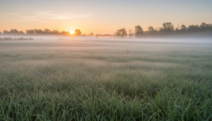
Why fog can return more than once overnight
The forecast mentions fog before 1 a.m., then again after 3 a.m. That may sound odd at first, but it fits a typical quiet-night setup.
Fog can develop early when the ground cools quickly after sunset. If a light breeze or slight temperature change disrupts it, visibility may improve for a while. Later in the night, as temperatures drop closer to the dew point again, fog can redevelop.
In practical terms, the exact timing matters less than the overall message: late night and early morning visibility may be reduced in spots. Use low beams, slow down, and leave more space between vehicles if fog forms. High beams usually reflect off the fog and make it harder to see.
Tuesday night stays partly cloudy with a low around 59 and calm wind. That is another quiet setup, though widespread bad weather is not expected. The calmer nights will feel pleasant, but they can support some patchy fog in the usual places.
Wednesday brings another round of unsettled weather
The midweek forecast turns active again on Wednesday. The day begins with only a slight chance of showers, then showers become likely after 2 p.m. A thunderstorm is possible as well. The chance of precipitation is 60 percent.
The high will be near 80, with calm wind becoming west at 5 to 7 mph in the afternoon. That means the day may start usable for outdoor work or travel, but the afternoon and early evening carry a higher risk for rain and storms.
Wednesday night keeps the unsettled pattern going at first. Showers are likely, and a thunderstorm is possible before 8 p.m. The chance of precipitation remains 60 percent. After that, conditions improve, and the night turns partly cloudy with a low around 57.
This timing matters for local routines. School sports practices, evening walks, lawn work, and late-day errands may run into wet weather. The best window on Wednesday appears to be earlier in the day, before showers become more likely.
If you have flexibility, handle weather-sensitive tasks before early afternoon. That includes mowing, painting, outdoor repairs, garden work, and longer drives. If you cannot shift plans, bring rain gear and keep an eye on the sky.
Wednesday does not look like an all-day washout from the forecast wording, but the afternoon looks unsettled enough to plan around. The “showers likely” wording signals a higher confidence that many areas will see rain at some point.
Thursday and Friday look like the cleanest stretch
After Wednesday evening’s showers move out, Thursday brings a welcome change. The forecast calls for sunshine and a high near 78. Thursday night looks mostly clear with a low around 54.
That is a classic comfortable Central New York day: warm enough for outdoor plans, cooler at night, and dry enough to get things done. The air should feel fresher compared with the damp start to the week.
Friday keeps the sunny pattern going, with a high near 80. Friday night turns partly cloudy with a low around 57. For planning purposes, Thursday and Friday are the best two-day stretch in the forecast.
This is the window to prioritize anything that needs dry weather:
Day | Forecast | Best use of the day |
Thursday | Sunny, high near 78 | Yard work, outdoor projects, walks, errands |
Thursday night | Mostly clear, low near 54 | Open-window weather where comfortable |
Friday | Sunny, high near 80 | Travel, outdoor dining, late-week plans |
Friday night | Partly cloudy, low near 57 | Comfortable evening conditions |
For gardeners and homeowners, the late-week dry stretch may help lawns and soil firm up after the early-week showers. For anyone commuting or traveling, Thursday and Friday should bring fewer weather-related slowdowns than today or Wednesday.
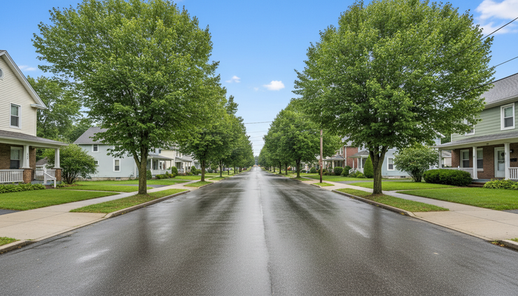
The weekend turns more uncertain again
The quiet stretch may not last through the full weekend. Saturday brings a chance of showers, though the day still looks mostly sunny overall. The chance of precipitation is 30 percent, and the high reaches near 82.
That suggests Saturday is not a guaranteed rain day. It may be warm and usable for much of the day, with a few showers possible. If planning outdoor events, Saturday looks better than Sunday at this point, but it still deserves a backup plan.
Saturday night brings a higher chance of showers at 40 percent. Skies turn mostly cloudy, and the low lands near 60. That increase in clouds and shower chances sets the stage for a wetter Sunday.
Sunday looks more unsettled. Showers are likely, and a thunderstorm is possible. The chance of precipitation rises to 60 percent, with a high near 78. If you need to choose between Saturday and Sunday for outdoor plans, Saturday currently has the edge.
Weekend details can shift as the week goes on, especially when thunderstorms are involved. Still, the signal is clear enough: the best late-week weather comes before the weekend, and Sunday has the stronger rain risk.
For people planning farmers market trips, lake visits, sports, or outdoor gatherings, the smarter move is to keep plans flexible. Saturday morning and midday may offer decent windows, while Sunday may require more patience.
A day-by-day look at the forecast
Here is the forecast in a simple planning format.
Period | What to expect | Temperature |
This afternoon | Showers and thunderstorms likely, mainly before 2 p.m.; partly sunny later | High near 81 |
Tonight | Partly cloudy with areas of fog before 1 a.m. and after 3 a.m. | Low near 61 |
Tuesday | Morning fog before 9 a.m., then mostly sunny | High near 81 |
Tuesday night | Partly cloudy and calm | Low near 59 |
Wednesday | Showers likely after 2 p.m., possible thunderstorm | High near 80 |
Wednesday night | Showers likely before 8 p.m., then partly cloudy | Low near 57 |
Thursday | Sunny | High near 78 |
Thursday night | Mostly clear | Low near 54 |
Friday | Sunny | High near 80 |
Friday night | Partly cloudy | Low near 57 |
Saturday | Mostly sunny with a chance of showers | High near 82 |
Saturday night | Mostly cloudy with a chance of showers | Low near 60 |
Sunday | Showers likely, possible thunderstorm | High near 78 |
This forecast has two main wet periods: this afternoon and Wednesday afternoon into early evening. The weekend brings another rain chance, especially Sunday. Between those systems, Thursday and Friday stand out as the calmest and brightest days.
How to plan around the changing pattern
A forecast like this rewards timing. The weather is not locked into one mood for the whole week, so small planning choices can make a big difference.
If commuting, the two times to watch most closely are foggy mornings and stormy afternoons. Fog may be most noticeable late tonight into Tuesday morning, especially in lower spots. Rain and thunder could slow things down this afternoon and again Wednesday afternoon.
If working outside, Tuesday after the fog lifts should be usable, but Thursday and Friday are stronger options. Wednesday morning may also work for shorter tasks, though the afternoon risk increases.
If planning recreation, the late week looks best. Thursday and Friday bring clear advantages for walking, biking, golfing, gardening, and simple outdoor time. Saturday may still work, but Sunday looks more likely to bring interruptions.
If watching for storms, remember that a 60 percent chance of precipitation does not mean rain all day. It means the odds favor measurable precipitation somewhere in the area. Thunderstorms can be brief but intense, and they can produce heavier rain than nearby places receive.

The main takeaway for Central New York
The next several days bring a mixed but manageable pattern. Today starts stormy, tonight and early Tuesday may turn foggy, and Wednesday brings another likely round of showers and possible thunder. After that, Thursday and Friday look sunny, pleasant, and easier to plan around.
The weekend is less settled. Saturday has a chance of showers but may still offer dry windows. Sunday carries the stronger signal for showers and a possible thunderstorm.
For the best weather window, aim for Thursday and Friday. For the trickiest travel conditions, watch this afternoon’s storms, late-night fog, Tuesday morning fog, and Wednesday afternoon showers. Keep plans flexible, and this week should still offer plenty of usable time between the wetter stretches.


Comments