Rainy Week Ahead: Showers, Thunderstorms, and a Midweek Warmup

Keep the rain gear close this week. Central New York is heading into a damp stretch, with several rounds of showers, a warmer push by Tuesday, and another cooler, unsettled pattern arriving late in the week.
The wettest periods look to be tonight, Tuesday into Tuesday night, and again Friday into Friday night. The week will not be a total washout, but dry windows may be brief, especially for outdoor work, school travel, fall sports, and anyone trying to squeeze in yard cleanup before colder air settles in.
For communities around Madison County and nearby parts of Central New York, the pattern has a familiar fall feel. Cloud cover will hold temperatures down at times, then a brief southerly flow will bring a milder day before showers and possible thunderstorms move through.
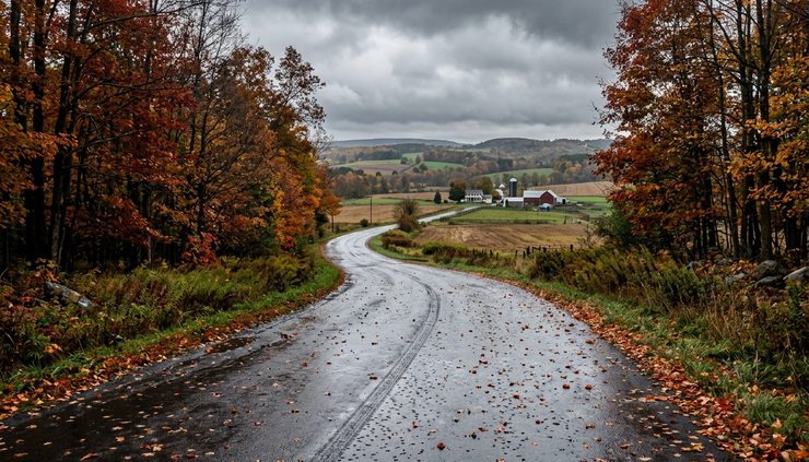
Showers build today and become steadier tonight
Today starts cloudy and stays that way for most of the day. Showers are likely, mainly after 3 p.m., with a high near 62 degrees. Winds will come from the east at 6 to 8 mph, so it will not be a windy day, but the combination of damp air and cloud cover may make it feel cooler than the number suggests.
Rainfall during the day should stay fairly light for many spots. New precipitation amounts are expected to run between one-tenth and one-quarter of an inch, though local totals can vary when showers move through in bands.
The better chance for widespread rain arrives tonight. Showers are expected, mainly before midnight, with a 90 percent chance of precipitation. The overnight low will settle near 48 degrees. East winds around 5 to 7 mph will become calm after midnight.
Tonight’s rainfall could be more meaningful, with new amounts between one-quarter and one-half inch possible. That is not usually enough to cause major problems by itself, but it can lead to ponding in the usual low spots, especially where leaves block storm drains or roadside ditches.
The main message for the first part of the week is simple: expect wet roads this evening and allow extra time where rain overlaps with travel.
If there is one evening to keep plans flexible, tonight is it. Rain may taper before the overnight hours are done, but roads and sidewalks will likely stay damp into early Monday.
Columbus Day brings a cloudy break
Columbus Day looks quieter, though not exactly bright. Expect mostly cloudy skies with a high near 66 degrees. Winds will start calm, then become west around 6 mph during the afternoon.
That makes Monday one of the better windows of the week for outdoor errands, short hikes, leaf pickup, or travel. It may not look pretty, but the overall setup is more manageable than the wetter periods on either side.
The air will stay mild for mid-October, and the lack of stronger wind should help the day feel comfortable when rain is not falling. Still, lingering moisture may keep the ground soft, especially after tonight’s rain.
Monday night turns mostly cloudy again. A slight chance of showers arrives after 2 a.m., with lows around 52 degrees and calm wind. The rain chance is low, around 20 percent, so many places may stay dry. Even so, the cloud cover will help keep temperatures from dropping much overnight.
Here is the early-week setup at a glance:
Period | Sky and precipitation | Temperature | Wind |
Today | Showers likely, mainly after 3 p.m. | High near 62 | East 6 to 8 mph |
Tonight | Showers, mainly before midnight | Low around 48 | East 5 to 7 mph, then calm |
Columbus Day | Mostly cloudy | High near 66 | Calm, then west around 6 mph |
Monday night | Slight chance of showers after 2 a.m. | Low around 52 | Calm |

Tuesday brings the warmest day and the strongest storm chance
Tuesday is the day to watch most closely. Temperatures will climb to around 73 degrees, making it the warmest day in the forecast. A south wind at 6 to 8 mph will help bring in milder air.
That warmth comes with a more active weather setup. Showers are likely at first, then showers and possibly a thunderstorm are expected after 11 a.m. The chance of precipitation is 80 percent.
Tuesday night remains unsettled, with showers and possibly a thunderstorm continuing. The low will be around 52 degrees, and the rain chance stays at 80 percent.
This does not automatically mean severe weather. The forecast wording points to showers and possible thunder rather than a clear severe storm signal. Still, any thunderstorm can bring brief heavier rain, quick changes in visibility, and wet roads during school pickup, evening travel, or outdoor events.
The warmer air also matters because it can make rainfall more efficient. When mild, moist air moves into Central New York, showers can become steadier or briefly heavier, especially along boundaries where winds shift.
A few practical points for Tuesday:
Keep a rain jacket or umbrella nearby through the afternoon and evening.
Plan for slower travel during heavier showers.
Bring outdoor items under cover if they do not handle repeated rain well.
Avoid parking over piles of leaves near drains, where water can collect quickly.
If thunder is heard, move indoors and wait for the storm to pass.
Tuesday may feel almost springlike for a short time because of the warmer air and thunder chance. That will not last long. By Wednesday, temperatures drop back closer to the early-week range.
Wednesday and Thursday offer a cooler pause
Wednesday starts with a chance of showers before 8 a.m., then trends drier. The day will stay mostly cloudy, with a high near 62 degrees. The chance of precipitation is 30 percent, so the morning may feature leftover damp spots rather than an all-day rain.
Wednesday night turns cooler, with mostly cloudy skies and a low around 40 degrees. That will feel like a clear step down from Tuesday night’s low near 52.
Thursday looks like the best weather day of the week. Expect mostly sunny skies and a high near 60 degrees. That makes it the strongest candidate for outdoor work, sports practices, errands, and leaf cleanup.
This midweek break will be useful, but it may be short. The next chance of showers arrives after 2 a.m. Thursday night, with mostly cloudy skies and a low around 40 degrees. The rain chance rises to 50 percent.
The pattern by Thursday night suggests the atmosphere will begin to reset into another wet stretch. Anyone trying to finish outdoor chores before Friday may want to use Thursday afternoon while the weather is more cooperative.

Friday and Saturday turn cooler and unsettled again
Friday brings showers likely, mostly cloudy skies, and a high near 62 degrees. The chance of precipitation is 70 percent. That suggests a fairly damp day, especially compared with the drier break on Thursday.
Friday night remains wet, with showers likely and a low around 37 degrees. The rain chance stays at 70 percent. That low stands out because it is the chilliest number in the forecast period. While the forecast calls for showers rather than snow, the colder feel will be noticeable, particularly early Saturday.
Saturday keeps a chance of showers, with mostly cloudy skies and a high near 52 degrees. The chance of precipitation is 50 percent.
That means the weekend may start gray, cool, and damp. It does not look like a warm fall weekend setup. Instead, it looks more like jacket weather with passing showers, wet leaves, and a chillier breeze if winds pick up locally.
The late-week shift also reinforces the need to think beyond rain. Repeated wet days can create small but annoying problems around homes and roads:
Leaves can mat down and clog drains.
Wet steps and decks can become slippery.
Farm fields, lawns, and trails may stay muddy.
Visibility can drop quickly under heavier showers.
Cooler nights can make damp clothing and gear feel much colder.
For drivers, the combination of rain and fallen leaves deserves extra attention. Wet leaves can reduce traction, especially on shaded roads, neighborhood streets, and rural curves. Leave extra room when stopping, and watch for standing water where shoulders dip.
The week favors flexible plans
This forecast has several wet periods, but it also has usable breaks. The key is timing.
The best chances for drier weather appear to be much of Columbus Day, parts of Wednesday after the morning, and especially Thursday. The most unsettled periods are tonight, Tuesday into Tuesday night, and Friday into Friday night.
Here is the broad pattern:
Day | Main weather story | Planning note |
Today | Showers likely later in the day | Keep rain gear handy after midafternoon |
Tonight | Wettest early-week period | Watch for slick roads and ponding |
Columbus Day | Mostly cloudy but quieter | A decent window for errands or short outdoor plans |
Tuesday | Warmer with showers and possible thunder | Expect changing conditions through the day |
Wednesday | Early shower chance, then mostly cloudy | Gradual improvement after morning |
Thursday | Mostly sunny and cooler | Best outdoor window of the week |
Friday | Showers likely | Plan for another damp day |
Saturday | Cool with a chance of showers | Keep weekend plans flexible |

What to do before the next round of rain
A rainy week ahead does not call for panic, but it does reward a little preparation. Small steps can prevent the usual fall headaches.
Clear leaves from drains, gutters, and driveway edges if it is safe to do so. Check sump pumps or basement trouble spots before the wetter late-week period. Bring in cushions, tools, and decorations that do poorly in repeated rain. If outdoor trash or recycling bins are light, secure them before showers move through.
For school mornings and commutes, build in a few extra minutes. Rain during the evening or overnight can leave wet leaves plastered to roadways long after showers end. That can be just as frustrating as rain falling in the moment.
For outdoor sports and community events, Tuesday and Friday are the trickiest days. Thursday looks far more favorable, with mostly sunny skies and a high near 60. Saturday will need a closer look as it gets nearer, since a 50 percent shower chance can still leave room for breaks between showers.
The biggest takeaway is that this week will change pace several times. It starts wet, pauses a bit for Columbus Day, warms up with a storm chance Tuesday, cools down midweek, then turns wet again before the weekend. Keep the umbrella nearby, use Thursday well, and expect roads, fields, and sidewalks to stay damp more often than not.



Comments