Rainy Start, Warmer Finish: A Week of Showers and Sunshine Ahead

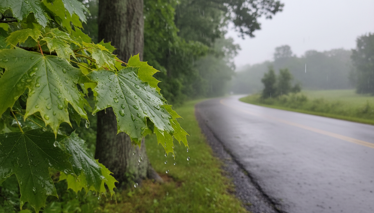
Heavy showers will keep Canastota damp through this afternoon and evening, with a brief thunderstorm possible before conditions slowly improve late Thursday and Friday. The wet start comes with a 90% chance of precipitation this afternoon, followed by an 80% chance tonight, before the forecast turns warmer and brighter heading into the weekend.
The main weather concern in the near term is rain. New rainfall amounts between a quarter and half an inch are possible this afternoon, with another quarter to half inch possible tonight. Patchy fog may also develop before 10 p.m., adding slower visibility to already wet roads.
By Friday, the pattern changes. Sunshine returns, highs climb into the lower 80s, and Saturday looks warmer still. The dry stretch may not last long, though, as showers return late Saturday night and become more likely Sunday.

Heavy rain leads the forecast through tonight
The first part of the forecast is the wettest. Canastota can expect showers this afternoon, with a thunderstorm also possible. The high will stay near 71 degrees, held down by clouds and rain.
Winds will not be a major issue. A northwest wind around 6 mph is expected this afternoon, which should keep the day feeling damp but not especially blustery. The larger concern is ongoing rain, ponding on roads, and a few heavier bursts if a thunderstorm develops.
Rain chances remain high tonight. Showers are expected mainly before 10 p.m., with a low around 59 degrees. Winds turn light out of the northwest, and patchy fog may form before 10 p.m.
That fog window matters because it lines up with the evening commute and early nighttime travel. Fog before 10 p.m., combined with wet roads, can make short drives feel slower than usual. Low beams, extra following distance, and reduced speed will help where visibility drops.
The wettest part of the forecast runs from this afternoon through tonight, when combined new rainfall could reach around one-half inch to one inch in spots.
That total is based on two forecast periods that each carry possible rainfall between a quarter and half an inch. Local amounts can vary, especially if a thunderstorm passes over the same area for a short time.
Thursday stays unsettled but less soaking
Thursday will not bring a clean break from the wet weather, but the rain chances ease.
A chance of showers continues, and thunderstorms are possible after 2 p.m. Patchy fog may linger before 7 a.m., then the day stays mostly cloudy. The high will reach near 77 degrees, making Thursday milder than today even with clouds in place.
The chance of precipitation drops to 40%. Most places that see rain Thursday are expected to pick up less than a tenth of an inch, with higher amounts possible under thunderstorms.
That shift is important. Today and tonight look like widespread, soaking rain chances. Thursday looks more scattered. Some areas may see showers, while others may only deal with clouds and a passing damp period.
Northwest winds will run from 3 to 8 mph. That is a light breeze by local standards, but it will help move moisture around enough to limit any long-lasting fog after the early morning period.
Thursday night looks quieter. Skies become partly cloudy, with a low around 59 degrees. A northwest wind around 5 mph will become calm in the evening.
The improvement Thursday night sets the stage for a much better Friday.
The short-range forecast at a glance
The next several forecast periods show a clear pattern. Rain is front-loaded, conditions improve late week, then a second round of unsettled weather returns around Sunday.
Period | Forecast | High or low | Rain chance | Main concern |
This afternoon | Showers, possible thunderstorm | High near 71 | 90% | Heavy rain and wet roads |
Tonight | Showers mainly before 10 p.m., patchy fog | Low near 59 | 80% | Fog and reduced visibility |
Thursday | Cloudy, chance of showers, storms after 2 p.m. | High near 77 | 40% | Scattered showers |
Thursday night | Partly cloudy | Low near 59 | Not listed | Calm, quieter conditions |
Friday | Mostly sunny | High near 81 | Not listed | Noticeably warmer |
Friday night | Partly cloudy | Low near 59 | Not listed | Quiet overnight weather |
Saturday | Partly sunny | High near 84 | Not listed | Warmest weekend day |
Saturday night | Showers possible after 2 a.m. | Low near 64 | 30% | Late-night showers |
Sunday | Showers likely, possible thunderstorm after 2 p.m. | High near 82 | 70% | Wet afternoon weather |
Sunday night | Showers likely early, then scattered storms and showers | Low near 62 | 60% | Evening storms |
Monday | Chance of showers and storms | High near 82 | 30% | Spotty unsettled weather |
Monday night | Chance of showers and storms | Low near 61 | 30% | Scattered showers |
Tuesday | Mostly sunny | High near 85 | Not listed | Warmer, brighter finish |
The numbers show two clear wet windows. The first arrives today into tonight. The second develops late Saturday night through Sunday night.
Between those two windows, Friday and much of Saturday offer the best opportunity for outdoor plans.
Friday brings the first real improvement
Friday stands out as the first broadly better day in the forecast.
The sky turns mostly sunny, and temperatures rise to near 81 degrees. Winds start calm, then become northwest at 5 to 7 mph in the afternoon.
That mix should make Friday feel more comfortable after the wet start to the week. The ground may still be damp in shaded or low-lying areas, but the day itself looks favorable for errands, yard work, sports practices, and other outdoor plans.
Friday night remains calm and seasonable. Partly cloudy skies are expected, with a low around 59 degrees. That is close to the lows expected Thursday night, but the difference is the lack of rain and fog in the forecast.
The air mass also starts to feel warmer heading into the weekend. Highs move from the lower 70s today, to the upper 70s Thursday, to the lower 80s Friday.
That warming trend continues Saturday.
Saturday looks warm before late-night showers return
Saturday should be partly sunny with a high near 84 degrees. That makes it one of the warmer days in the forecast, and likely one of the better windows for daytime outdoor activity.
The forecast does not list daytime rain for Saturday. Conditions change Saturday night, when a chance of showers returns after 2 a.m. Skies become mostly cloudy, and the low will settle around 64 degrees. The chance of precipitation is 30%.
That timing matters for weekend planning. Saturday daytime looks much more favorable than Saturday night and Sunday. Anyone planning outdoor work, local events, or travel may find Saturday daylight hours to be the better choice.
By late Saturday night, moisture starts to increase again. Even though the rain chance is modest at 30%, the return of showers after 2 a.m. signals the next wetter pattern.
Sunday looks much more unsettled.
Sunday may be the next widespread wet day
Sunday brings the highest rain chance after the early-week soaking.
The day starts with a chance of showers, then showers become likely after 2 p.m. A thunderstorm is also possible. Skies stay mostly cloudy, with a high near 82 degrees. The chance of precipitation is 70%.
The Sunday forecast has a familiar shape. Early-day showers may be scattered, then the afternoon looks more active. Thunderstorms are possible later in the day, which means rain could arrive in heavier, more uneven bursts.
Sunday night remains unsettled. Showers are likely, and a thunderstorm is possible before 8 p.m. After that, a chance of showers and thunderstorms continues between 8 p.m. and 2 a.m., followed by a chance of showers after 2 a.m.
The low will be around 62 degrees, and the chance of precipitation is 60%.
The highest-impact period on Sunday appears to be the afternoon into the early evening. That is when showers become likely and storms are mentioned. Outdoor plans during that window should have a rain backup.
Some rain could fall before Sunday afternoon, but the forecast points to the later part of the day as the main period to watch.

Monday stays partly unsettled before Tuesday brightens
Monday does not look completely dry, but the rain chance drops compared with Sunday.
A chance of showers and thunderstorms continues Monday. Skies will be partly sunny, with a high near 82 degrees. The chance of precipitation is 30%.
Monday night carries the same 30% chance for showers and thunderstorms. Skies turn partly cloudy, with a low around 61 degrees.
That means Monday is not a washout in the current forecast. It is better described as a day with spotty shower and storm chances. Some periods may be dry, especially compared with Sunday.
Tuesday brings the warmest and brightest finish of the forecast period. Mostly sunny skies are expected, with a high near 85 degrees.
That forecast gives the week a clear arc. Rain opens the period, a brief warm and dry break follows, Sunday brings another active system, and Tuesday ends warmer with sunshine.
For Canastota Weather, the practical takeaway is simple. The best windows for dry outdoor time look to be Friday, much of Saturday, and Tuesday. The most likely wet periods are this afternoon, tonight, and Sunday afternoon into Sunday night.
Rainfall may be enough to slow travel but not driven by wind
Wind will stay light through most of the forecast. That helps limit concerns for downed limbs or wind-driven rain, but it does not remove the impact of steady showers.
This afternoon’s northwest wind around 6 mph and Thursday’s 3 to 8 mph breeze are not strong. Friday afternoon winds may run 5 to 7 mph out of the northwest. These are gentle winds, not a headline part of the forecast.
Water on roads is more meaningful. During heavier showers, especially this afternoon and tonight, puddles may form in poor drainage areas. Low spots, side streets, and parking lots can collect water quickly during repeated bursts of rain.
Drivers should watch for:
Standing water along curb lines
Spray from larger vehicles
Reduced visibility in heavier showers
Fog before 10 p.m. tonight
Slick pavement after the first rounds of rain
The forecast does not point to extreme weather, but routine rain impacts can still slow travel. That is especially true during commuting hours and after dark.
Thunderstorms are possible this afternoon, Thursday afternoon after 2 p.m., Sunday afternoon, Sunday evening, and again on Monday. Any thunderstorm can bring briefly heavier rain than surrounding areas. If thunder is heard, people should move indoors until the storm passes.
Temperature trend points upward after the rainy start
Temperatures rise steadily after today.
The high near 71 this afternoon is the coolest daytime high in the forecast period. Thursday climbs to near 77. Friday reaches near 81. Saturday rises to near 84. Sunday and Monday both sit near 82, with Tuesday pushing to near 85.
That makes the forecast feel less like a cool, soggy stretch and more like a wet start followed by a warm finish.
Overnight lows stay fairly consistent. Tonight, Thursday night, and Friday night all land near 59 degrees. Saturday night is milder near 64, helped by clouds and increasing moisture. Sunday night drops to around 62, and Monday night settles near 61.
The mild nights are another sign that a warmer air pattern is taking hold. Even with showers around, the forecast does not show a sharp cool-down after the rain moves through.
For gardens, lawns, and outdoor work, the pattern brings both moisture and warm temperatures. The ground may stay soft after today and tonight, especially if rainfall reaches the higher end of the expected range. Friday sunshine should help drying, but shaded areas may remain damp into the weekend.
Best planning windows are late week and Tuesday
The forecast offers several breaks, but they are not evenly spaced.
The first good planning window begins Friday morning and lasts through at least Saturday daytime. Friday looks mostly sunny, and Saturday is partly sunny. Rain chances do not return until after 2 a.m. Saturday night.
That makes Friday and Saturday the strongest options for:
Lawn mowing after surfaces dry
Outdoor sports and practices
Walking, biking, or local recreation
Travel without widespread rain
Drying out patios, driveways, and equipment
Sunday is much less favorable. Showers become likely after 2 p.m., and storms are possible. Even if the morning has dry stretches, the afternoon and evening carry higher weather risk for outdoor plans.
Monday is more mixed. A 30% chance of showers and thunderstorms means the day could include long dry stretches, but it should not be treated as fully clear.
Tuesday stands out as the next broad dry signal. Mostly sunny skies and a high near 85 should make it one of the most pleasant days in the forecast, assuming the current outlook holds.

What comes next in the forecast
The next 24 hours remain the most active part of the short-term forecast. Showers this afternoon and tonight are likely, with patchy fog tonight before 10 p.m. Thursday keeps a smaller shower chance in place, especially with thunderstorms possible after 2 p.m.
After that, the forecast turns more comfortable. Friday should bring sun and a high near 81, followed by a warmer Saturday near 84.
The next period to monitor is late Saturday night through Sunday night. Showers return after 2 a.m. Saturday night, then become likely Sunday afternoon. Thunderstorms are possible Sunday into Sunday night, and a lingering chance remains Monday.
By Tuesday, the forecast points back to mostly sunny skies and a high near 85.
The week starts wet, turns warmer, and ends with the better side of late-season sunshine. For now, the main plan is to get through today’s rain, use Friday and Saturday for outdoor time, and keep an eye on Sunday’s renewed shower and thunderstorm chances.


Comments