Rainy Start, Sunny Finish: Your 7-Day Weather Outlook

A wet and unsettled stretch will open the week, with rounds of showers and thunderstorms expected Tuesday through Thursday before drier, warmer weather takes hold Friday and Saturday. The forecast calls for a 100% chance of precipitation Tuesday, followed by additional rain chances through midweek and a more comfortable finish heading into the weekend.
Periods of heavy rainfall are possible early in the outlook, especially Tuesday and Tuesday night, when new rainfall totals may reach three quarters of an inch to 1 inch during each forecast period. Temperatures will stay mild despite the clouds and rain, with highs mostly in the mid to upper 70s before climbing into the low 80s by Friday and Saturday.

Tuesday brings the highest rain chance
Tuesday is expected to be the wettest day of the period, with showers and thunderstorms likely before 1 p.m. More showers, and possibly another thunderstorm, are expected mainly after 1 p.m.
The high will be near 77 degrees. Winds will stay light, coming from the southeast at 3 to 8 mph. Rain will be widespread, with the chance of precipitation at 100%.
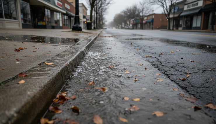
Rainfall totals could add up quickly. New rainfall amounts between three quarters of an inch and 1 inch are possible during the day. That may lead to ponding on roads, slower commutes, and reduced visibility during heavier downpours.
Tuesday night stays rainy. Showers and possibly a thunderstorm remain in the forecast, with a low near 62. The southeast wind around 6 mph will become light and variable after midnight. The chance of precipitation drops only slightly to 90%, with another three quarters of an inch to 1 inch of precipitation possible.
Wednesday keeps showers and storms in place
The unsettled pattern continues Wednesday. Showers are likely during the morning, then showers and possibly a thunderstorm are expected after 11 a.m.
The high will be near 75 degrees. Winds will shift during the day, starting from the west at 5 to 8 mph and becoming east in the morning. The chance of precipitation remains high at 90%.
Rainfall amounts should be lower than Tuesday, but still noticeable. New rainfall between a quarter and half of an inch is possible.
Wednesday night will stay cloudy, with showers likely and possibly a thunderstorm before 2 a.m. After that, rain chances ease to a chance of showers. The low will be around 60. A north wind near 6 mph will become calm in the evening. The chance of precipitation is 70%.
Thursday marks the transition
Thursday will not bring a full break from wet weather, but it does mark the start of a slow improvement.
A chance of showers is expected early, followed by showers likely and possibly a thunderstorm after 2 p.m. Skies will be mostly cloudy, and the high will be near 77 degrees. The chance of precipitation is 70%.
Thursday night brings one more push of rain, with showers likely before 8 p.m. After that, conditions trend quieter. The night will remain mostly cloudy, with a low around 59. The chance of precipitation is 60%.
The key change by Thursday night is timing. Instead of rain lasting through much of the night, the better chance for showers comes early. That sets up a drier and brighter turn for Friday.
Friday and Saturday bring the best weather window
Friday looks like the first clear improvement of the outlook. Mostly sunny skies are forecast, with a high near 81 degrees.
Friday night will be partly cloudy, with a low around 60. That combination should make Friday the best day for outdoor plans after several rounds of rain.
Saturday continues the better stretch, though clouds return at times. The forecast calls for partly sunny skies and a high near 83. Saturday night will be mostly cloudy, with a low near 64.
For anyone watching the timing of the week, Friday and Saturday stand out as the driest and warmest days. After a soggy start, the weekend begins on a much better note.

Rain chances return late in the weekend
The dry break may not last through the full weekend. Sunday brings a chance of showers and thunderstorms under mostly cloudy skies. The high will be near 83, with a 50% chance of precipitation.
Sunday night remains unsettled, with a chance of showers and thunderstorms and mostly cloudy skies. The low will be around 63. The chance of precipitation is 40%.
Monday keeps a lower but still present rain chance in the outlook. A chance of showers and thunderstorms remains, with partly sunny skies and a high near 82. The chance of precipitation is 30%.
The pattern suggests a move away from the widespread rain expected early in the week and toward more scattered storm chances by Sunday and Monday.
Daily forecast at a glance
Day | Forecast | High and low | Rain chance |
Tuesday | Showers and thunderstorms | High 77 | 100% |
Tuesday night | Showers and possibly a thunderstorm | Low 62 | 90% |
Wednesday | Showers likely, then storms possible after 11 a.m. | High 75 | 90% |
Wednesday night | Showers likely before 2 a.m., then chance of showers | Low 60 | 70% |
Thursday | Showers likely, possible thunderstorm after 2 p.m. | High 77 | 70% |
Thursday night | Showers likely before 8 p.m. | Low 59 | 60% |
Friday | Mostly sunny | High 81 | Not listed |
Friday night | Partly cloudy | Low 60 | Not listed |
Saturday | Partly sunny | High 83 | Not listed |
Saturday night | Mostly cloudy | Low 64 | Not listed |
Sunday | Chance of showers and thunderstorms | High 83 | 50% |
Sunday night | Chance of showers and thunderstorms | Low 63 | 40% |
Monday | Chance of showers and thunderstorms | High 82 | 30% |
What to watch through the week
The main concern early in the outlook is repeated rainfall. Tuesday and Tuesday night could each bring three quarters of an inch to 1 inch of new rainfall, with more rain expected Wednesday.
That does not mean every location will see the same totals, especially where thunderstorms develop. Storms can create sharp differences over short distances, with one area seeing brief heavy rain while another sees lighter showers.
The practical takeaway is simple: expect wet roads, allow extra travel time during heavier showers, and keep an eye on changing conditions during thunderstorms.

The week starts with a soaking, stormy pattern, then improves by Friday and Saturday with sunshine and highs in the low 80s. Rain and thunderstorm chances return Sunday and Monday, but at lower odds than the early-week system.


Comments