Afternoon Weather Outlook Showers Thunderstorms and Smoke Ahead
- edu.plus.weatherray Rome
- Aug 6, 2025
- 3 min read

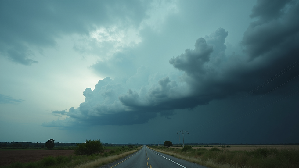
As the afternoon unfolds, many of you are likely curious about the changing weather conditions. Today brings a 50% chance of showers and thunderstorms after 2 PM, making it essential to prepare for varying conditions. Additionally, areas of smoke can impact the atmosphere, creating a unique twist to today's forecast. Let's dive into what these weather patterns will mean for your afternoon plans.
Afternoon Forecast: What to Expect
This afternoon will be partly sunny, with high temperatures reaching around 84°F. Although you may see some sun breaking through, thunderstorms are likely. Winds will be calm, with speeds around 5 mph from the southeast, setting the stage for potential storm development.
If you're headed out, keep an umbrella handy. New rainfall could range between 0.1 to 0.25 inches, but localized areas may experience higher totals during intense downpours. As we approach 2 PM, the atmosphere will become increasingly unstable, which could lead not just to rain but also to some stronger thunderstorms.
Evening Expectations: Transitioning Conditions
As evening approaches, the forecast remains dynamic. Thunderstorms and showers may linger until 2 AM. Smoke from earlier conditions might persist, affecting how the air feels and looks throughout the night.
Expect temperatures to drop to a comfortable low of 63°F. While there is only a 20% chance of precipitation at night, those planning late outdoor activities should note that the clouds will blanket the sky, resulting in a mostly gray atmosphere.

Thursday's Outlook: More of the Same
Looking toward Thursday, residents can expect a continuation of today's weather patterns. The forecast again predicts a 30% chance of showers and thunderstorms after 2 PM, with highs peaking near 83°F. Smoke in the air may linger, and winds remain light from the southeast.
Here’s a statistic to consider: last year, similar weather conditions resulted in nearly 3 inches of rainfall over the course of the week in our region. While storm activity may be less intense this time, it is still vital for those with respiratory issues to remain cautious due to potential air quality concerns.
The Weekend Preview: Sunny Days Ahead
After a week of storms and smoke, the weekend promises a welcome change. Friday is expected to bring sunny conditions with highs around 85°F. Light winds between 3 and 6 mph will make outdoor activities enjoyable, but don't forget sun protection as UV exposure increases.
Saturday will follow suit with sunny skies and temperatures climbing to about 87°F. The evenings will hold a pleasant warmth, dropping to around 65°F.
By Sunday, the warmth peaks at 90°F, offering fantastic opportunities for outdoor gatherings or simply enjoying nature. Nighttime temperatures will be comfortable, settling around 68°F.
Into Next Week: The Heat Lingers
As we enter Monday, warm temperatures will continue, with daytime highs reaching about 92°F. Expect partly cloudy nights with lows around 69°F, maintaining the trend of warm summer weather.
Tuesday is forecasted to stay sunny, with highs close to 91°F. This continuation of pleasant weather will delight summer lovers looking to make the most of these warm days.
Stay Weather Aware!
To sum up, today's forecast indicates notable changes, with showers, thunderstorms, and smoke all on the horizon. While we can look forward to sunnier conditions towards the weekend, staying vigilant is crucial.
For anyone planning activities outside, keep an eye on the weather updates, especially given the unpredictable nature of thunderstorms. Remember to stay cool and hydrated as summer temperatures rise.
Be prepared for the changing conditions, and look forward to enjoying clear skies soon!


Comments